You are here: Home > Network List > TA - USArray Transportable Network (new EarthScope stations) Stations List
> Station J23A Dilts Ranch, Bill, WY, USA > Earthquake Result Viewer
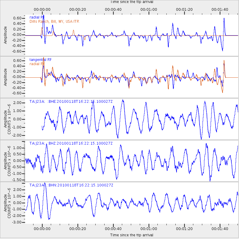
J23A Dilts Ranch, Bill, WY, USA - Earthquake Result Viewer
*The percent match for this event was below the threshold and hence no stack was calculated.
| Earthquake location: |
Santa Cruz Islands |
| Earthquake latitude/longitude: |
-12.5/166.3 |
| Earthquake time(UTC): |
2010/01/18 (018) 16:09:14 GMT |
| Earthquake Depth: |
10 km |
| Earthquake Magnitude: |
5.5 MB, 5.4 MS, 5.7 MW, 5.7 MW |
| Earthquake Catalog/Contributor: |
WHDF/NEIC |
|
| Network: |
TA USArray Transportable Network (new EarthScope stations) |
| Station: |
J23A Dilts Ranch, Bill, WY, USA |
| Lat/Lon: |
43.40 N/105.55 W |
| Elevation: |
1499 m |
|
| Distance: |
97.1 deg |
| Az: |
47.234 deg |
| Baz: |
259.661 deg |
| Ray Param: |
$rayparam |
*The percent match for this event was below the threshold and hence was not used in the summary stack. |
|
| Radial Match: |
49.97953 % |
| Radial Bump: |
400 |
| Transverse Match: |
36.662025 % |
| Transverse Bump: |
400 |
| SOD ConfigId: |
296938 |
| Insert Time: |
2010-04-06 21:52:59.254 +0000 |
| GWidth: |
2.5 |
| Max Bumps: |
400 |
| Tol: |
0.001 |
|
Signal To Noise
| Channel | StoN | STA | LTA |
| TA:J23A: :BHZ:20100118T16:22:15.100027Z | 1.5801429 | 7.133987E-7 | 4.5147738E-7 |
| TA:J23A: :BHN:20100118T16:22:15.100027Z | 2.3111029 | 1.9808815E-6 | 8.571152E-7 |
| TA:J23A: :BHE:20100118T16:22:15.100027Z | 1.3650496 | 9.459235E-7 | 6.92959E-7 |
| Arrivals |
| Ps | |
| PpPs | |
| PsPs/PpSs | |


