You are here: Home > Network List > AZ - ANZA Regional Network Stations List
> Station SMER AZ.SMER > Earthquake Result Viewer
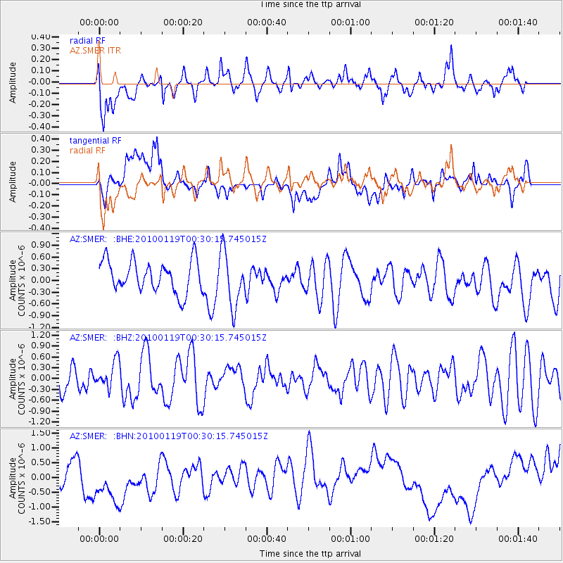
SMER AZ.SMER - Earthquake Result Viewer
*The percent match for this event was below the threshold and hence no stack was calculated.
| Earthquake location: |
Solomon Islands |
| Earthquake latitude/longitude: |
-9.0/158.1 |
| Earthquake time(UTC): |
2010/01/19 (019) 00:17:48 GMT |
| Earthquake Depth: |
39 km |
| Earthquake Magnitude: |
5.5 MB, 5.4 MS |
| Earthquake Catalog/Contributor: |
WHDF/NEIC |
|
| Network: |
AZ ANZA Regional Network |
| Station: |
SMER AZ.SMER |
| Lat/Lon: |
33.46 N/117.17 W |
| Elevation: |
355 m |
|
| Distance: |
90.6 deg |
| Az: |
56.36 deg |
| Baz: |
259.664 deg |
| Ray Param: |
$rayparam |
*The percent match for this event was below the threshold and hence was not used in the summary stack. |
|
| Radial Match: |
55.815323 % |
| Radial Bump: |
400 |
| Transverse Match: |
26.934187 % |
| Transverse Bump: |
400 |
| SOD ConfigId: |
296938 |
| Insert Time: |
2010-04-06 21:56:03.793 +0000 |
| GWidth: |
2.5 |
| Max Bumps: |
400 |
| Tol: |
0.001 |
|
Signal To Noise
| Channel | StoN | STA | LTA |
| AZ:SMER: :BHZ:20100119T00:30:15.745015Z | 1.1550338 | 3.847105E-7 | 3.3307293E-7 |
| AZ:SMER: :BHN:20100119T00:30:15.745015Z | 1.996758 | 1.0354454E-6 | 5.185633E-7 |
| AZ:SMER: :BHE:20100119T00:30:15.745015Z | 1.7938279 | 7.148195E-7 | 3.9848837E-7 |
| Arrivals |
| Ps | |
| PpPs | |
| PsPs/PpSs | |


