You are here: Home > Network List > US - United States National Seismic Network Stations List
> Station EGMT Eagleton, Montana, USA > Earthquake Result Viewer
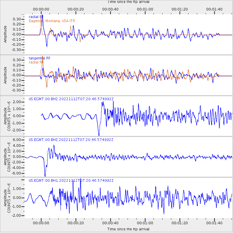
EGMT Eagleton, Montana, USA - Earthquake Result Viewer
*The percent match for this event was below the threshold and hence no stack was calculated.
| Earthquake location: |
Fiji Islands Region |
| Earthquake latitude/longitude: |
-20.1/-178.4 |
| Earthquake time(UTC): |
2022/11/12 (316) 07:09:14 GMT |
| Earthquake Depth: |
587 km |
| Earthquake Magnitude: |
7.0 mww |
| Earthquake Catalog/Contributor: |
NEIC PDE/us |
|
| Network: |
US United States National Seismic Network |
| Station: |
EGMT Eagleton, Montana, USA |
| Lat/Lon: |
48.02 N/109.75 W |
| Elevation: |
1055 m |
|
| Distance: |
91.3 deg |
| Az: |
38.698 deg |
| Baz: |
241.073 deg |
| Ray Param: |
$rayparam |
*The percent match for this event was below the threshold and hence was not used in the summary stack. |
|
| Radial Match: |
72.90651 % |
| Radial Bump: |
400 |
| Transverse Match: |
71.74215 % |
| Transverse Bump: |
400 |
| SOD ConfigId: |
29756493 |
| Insert Time: |
2022-11-26 07:45:25.926 +0000 |
| GWidth: |
2.5 |
| Max Bumps: |
400 |
| Tol: |
0.001 |
|
Signal To Noise
| Channel | StoN | STA | LTA |
| US:EGMT:00:BHZ:20221112T07:20:46.574992Z | 16.614632 | 2.8794625E-6 | 1.7330885E-7 |
| US:EGMT:00:BH1:20221112T07:20:46.574992Z | 1.5740429 | 4.5265753E-7 | 2.8757637E-7 |
| US:EGMT:00:BH2:20221112T07:20:46.574992Z | 4.465383 | 1.098231E-6 | 2.4594328E-7 |
| Arrivals |
| Ps | |
| PpPs | |
| PsPs/PpSs | |


