You are here: Home > Network List > TA - USArray Transportable Network (new EarthScope stations) Stations List
> Station H20A Greybull, WY, USA > Earthquake Result Viewer
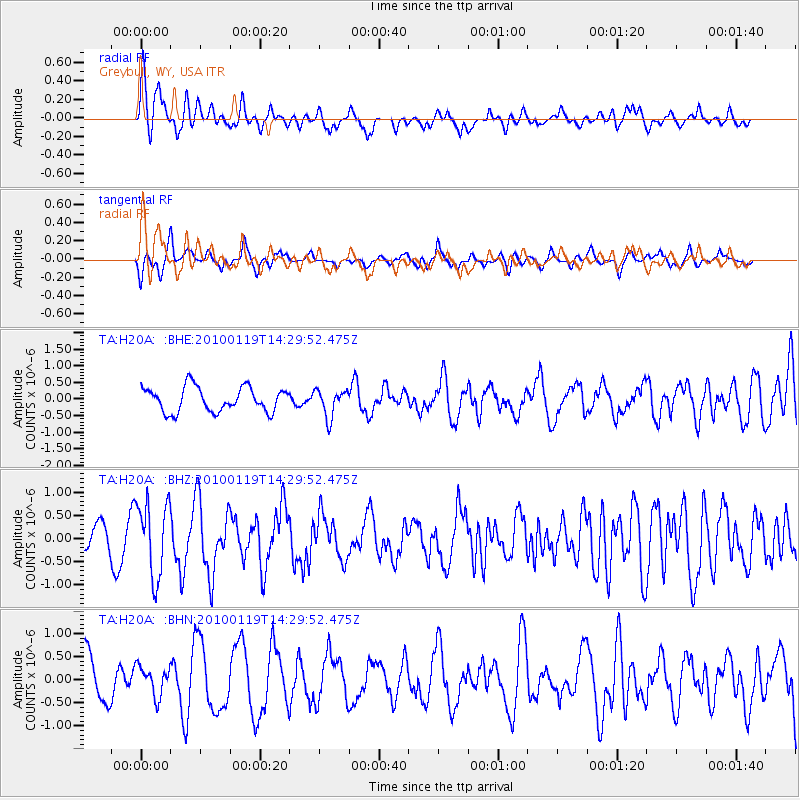
H20A Greybull, WY, USA - Earthquake Result Viewer
*The percent match for this event was below the threshold and hence no stack was calculated.
| Earthquake location: |
Cuba Region |
| Earthquake latitude/longitude: |
19.0/-80.8 |
| Earthquake time(UTC): |
2010/01/19 (019) 14:23:38 GMT |
| Earthquake Depth: |
10 km |
| Earthquake Magnitude: |
5.7 MB, 5.4 MS, 5.9 MW, 5.9 MW |
| Earthquake Catalog/Contributor: |
WHDF/NEIC |
|
| Network: |
TA USArray Transportable Network (new EarthScope stations) |
| Station: |
H20A Greybull, WY, USA |
| Lat/Lon: |
44.49 N/108.00 W |
| Elevation: |
1236 m |
|
| Distance: |
34.1 deg |
| Az: |
324.267 deg |
| Baz: |
129.466 deg |
| Ray Param: |
$rayparam |
*The percent match for this event was below the threshold and hence was not used in the summary stack. |
|
| Radial Match: |
73.468834 % |
| Radial Bump: |
400 |
| Transverse Match: |
61.38327 % |
| Transverse Bump: |
400 |
| SOD ConfigId: |
296938 |
| Insert Time: |
2010-04-06 22:06:02.917 +0000 |
| GWidth: |
2.5 |
| Max Bumps: |
400 |
| Tol: |
0.001 |
|
Signal To Noise
| Channel | StoN | STA | LTA |
| TA:H20A: :BHZ:20100119T14:29:52.475Z | 1.9816262 | 8.002093E-7 | 4.0381448E-7 |
| TA:H20A: :BHN:20100119T14:29:52.475Z | 0.68546736 | 3.2037525E-7 | 4.6738222E-7 |
| TA:H20A: :BHE:20100119T14:29:52.475Z | 1.1333548 | 4.1590445E-7 | 3.6696758E-7 |
| Arrivals |
| Ps | |
| PpPs | |
| PsPs/PpSs | |


