You are here: Home > Network List > TA - USArray Transportable Network (new EarthScope stations) Stations List
> Station F22A Rosebud, MT, USA > Earthquake Result Viewer
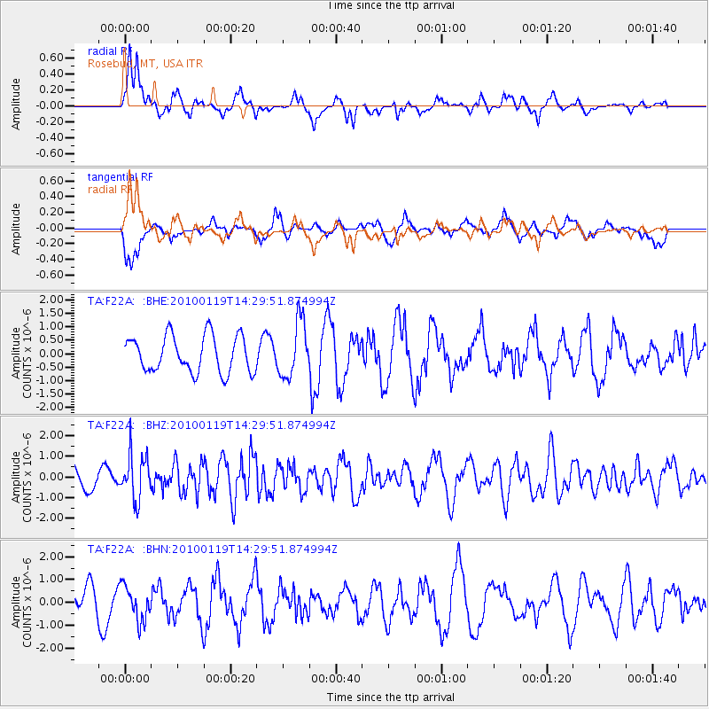
F22A Rosebud, MT, USA - Earthquake Result Viewer
*The percent match for this event was below the threshold and hence no stack was calculated.
| Earthquake location: |
Cuba Region |
| Earthquake latitude/longitude: |
19.0/-80.8 |
| Earthquake time(UTC): |
2010/01/19 (019) 14:23:38 GMT |
| Earthquake Depth: |
10 km |
| Earthquake Magnitude: |
5.7 MB, 5.4 MS, 5.9 MW, 5.9 MW |
| Earthquake Catalog/Contributor: |
WHDF/NEIC |
|
| Network: |
TA USArray Transportable Network (new EarthScope stations) |
| Station: |
F22A Rosebud, MT, USA |
| Lat/Lon: |
45.78 N/106.26 W |
| Elevation: |
882 m |
|
| Distance: |
34.0 deg |
| Az: |
327.457 deg |
| Baz: |
133.341 deg |
| Ray Param: |
$rayparam |
*The percent match for this event was below the threshold and hence was not used in the summary stack. |
|
| Radial Match: |
48.62424 % |
| Radial Bump: |
390 |
| Transverse Match: |
45.140182 % |
| Transverse Bump: |
400 |
| SOD ConfigId: |
296938 |
| Insert Time: |
2010-04-06 22:09:04.858 +0000 |
| GWidth: |
2.5 |
| Max Bumps: |
400 |
| Tol: |
0.001 |
|
Signal To Noise
| Channel | StoN | STA | LTA |
| TA:F22A: :BHZ:20100119T14:29:51.874994Z | 2.4852786 | 1.0865074E-6 | 4.3717728E-7 |
| TA:F22A: :BHN:20100119T14:29:51.874994Z | 1.1104596 | 7.593593E-7 | 6.8382434E-7 |
| TA:F22A: :BHE:20100119T14:29:51.874994Z | 1.5456725 | 1.04154E-6 | 6.7384264E-7 |
| Arrivals |
| Ps | |
| PpPs | |
| PsPs/PpSs | |


