You are here: Home > Network List > TA - USArray Transportable Network (new EarthScope stations) Stations List
> Station F28A McLaughlin, SD, USA > Earthquake Result Viewer
F28A McLaughlin, SD, USA - Earthquake Result Viewer
*The percent match for this event was below the threshold and hence no stack was calculated.
| Earthquake location: |
Cuba Region |
| Earthquake latitude/longitude: |
19.0/-80.8 |
| Earthquake time(UTC): |
2010/01/19 (019) 14:23:38 GMT |
| Earthquake Depth: |
10 km |
| Earthquake Magnitude: |
5.7 MB, 5.4 MS, 5.9 MW, 5.9 MW |
| Earthquake Catalog/Contributor: |
WHDF/NEIC |
|
| Network: |
TA USArray Transportable Network (new EarthScope stations) |
| Station: |
F28A McLaughlin, SD, USA |
| Lat/Lon: |
45.85 N/100.80 W |
| Elevation: |
633 m |
|
| Distance: |
31.5 deg |
| Az: |
332.748 deg |
| Baz: |
141.695 deg |
| Ray Param: |
$rayparam |
*The percent match for this event was below the threshold and hence was not used in the summary stack. |
|
| Radial Match: |
55.677723 % |
| Radial Bump: |
357 |
| Transverse Match: |
44.258167 % |
| Transverse Bump: |
400 |
| SOD ConfigId: |
296938 |
| Insert Time: |
2010-04-06 22:12:58.031 +0000 |
| GWidth: |
2.5 |
| Max Bumps: |
400 |
| Tol: |
0.001 |
|
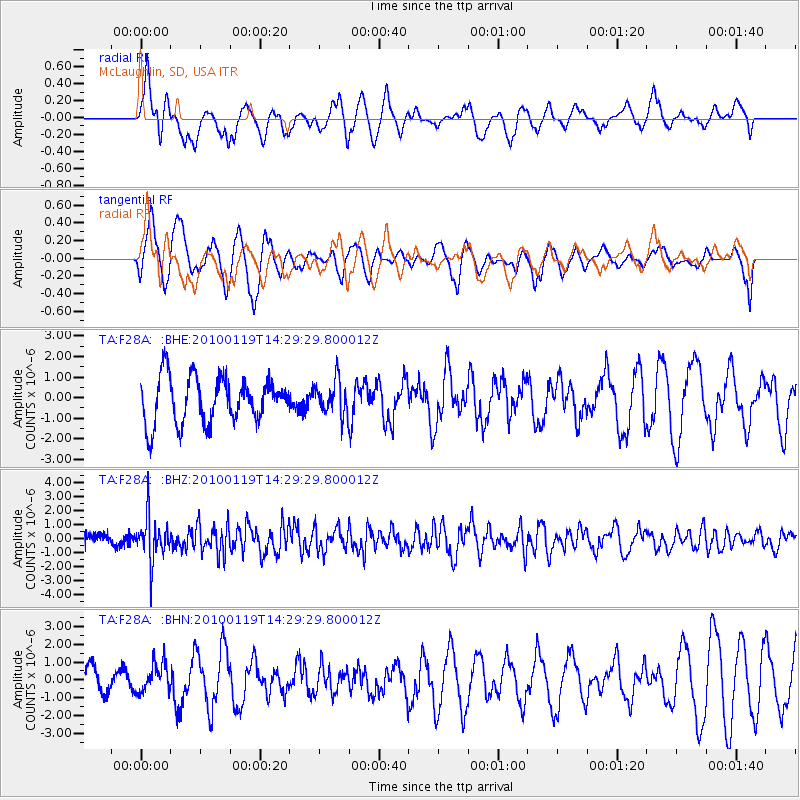
Signal To Noise
| Channel | StoN | STA | LTA |
| TA:F28A: :BHZ:20100119T14:29:29.800012Z | 3.411078 | 1.5543798E-6 | 4.556858E-7 |
| TA:F28A: :BHN:20100119T14:29:29.800012Z | 0.6620326 | 8.15258E-7 | 1.2314468E-6 |
| TA:F28A: :BHE:20100119T14:29:29.800012Z | 0.7776242 | 8.5762207E-7 | 1.1028748E-6 |
| Arrivals |
| Ps | |
| PpPs | |
| PsPs/PpSs | |


