You are here: Home > Network List > UW - Pacific Northwest Regional Seismic Network Stations List
> Station UMAT Pilot Rock, OR, USA > Earthquake Result Viewer
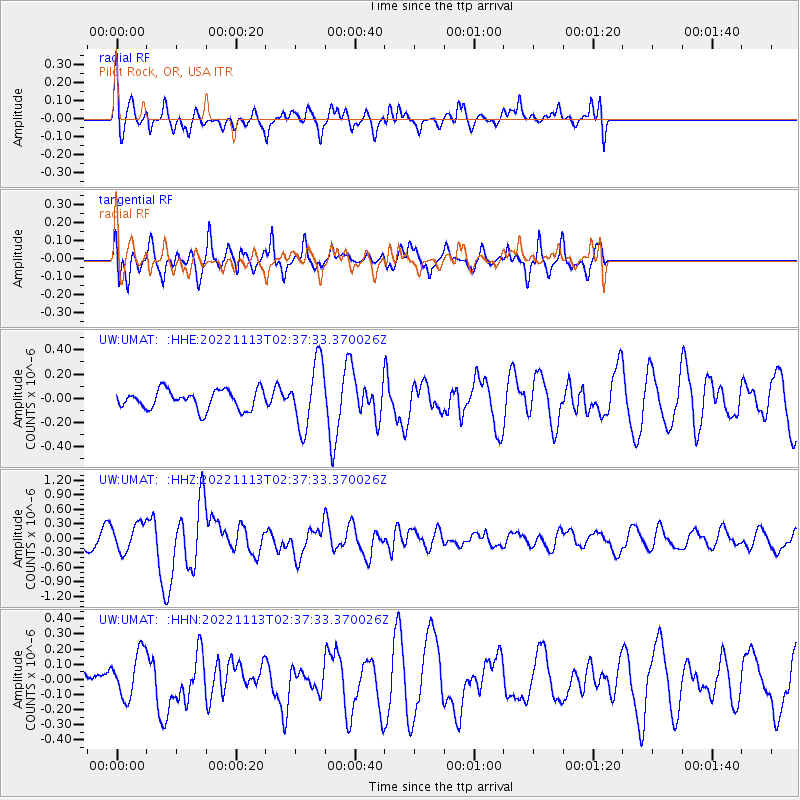
UMAT Pilot Rock, OR, USA - Earthquake Result Viewer
*The percent match for this event was below the threshold and hence no stack was calculated.
| Earthquake location: |
Near Coast Of Central Chile |
| Earthquake latitude/longitude: |
-37.5/-73.7 |
| Earthquake time(UTC): |
2022/11/13 (317) 02:24:57 GMT |
| Earthquake Depth: |
18 km |
| Earthquake Magnitude: |
6.2 mww |
| Earthquake Catalog/Contributor: |
NEIC PDE/us |
|
| Network: |
UW Pacific Northwest Regional Seismic Network |
| Station: |
UMAT Pilot Rock, OR, USA |
| Lat/Lon: |
45.29 N/118.96 W |
| Elevation: |
1318 m |
|
| Distance: |
91.9 deg |
| Az: |
329.913 deg |
| Baz: |
145.587 deg |
| Ray Param: |
$rayparam |
*The percent match for this event was below the threshold and hence was not used in the summary stack. |
|
| Radial Match: |
53.90898 % |
| Radial Bump: |
400 |
| Transverse Match: |
59.916035 % |
| Transverse Bump: |
400 |
| SOD ConfigId: |
29756493 |
| Insert Time: |
2022-11-27 03:14:51.369 +0000 |
| GWidth: |
2.5 |
| Max Bumps: |
400 |
| Tol: |
0.001 |
|
Signal To Noise
| Channel | StoN | STA | LTA |
| UW:UMAT: :HHZ:20221113T02:37:33.370026Z | 2.6085052 | 2.8558614E-7 | 1.09482684E-7 |
| UW:UMAT: :HHN:20221113T02:37:33.370026Z | 1.233256 | 1.5180764E-7 | 1.2309499E-7 |
| UW:UMAT: :HHE:20221113T02:37:33.370026Z | 3.4022722 | 2.6715907E-7 | 7.852372E-8 |
| Arrivals |
| Ps | |
| PpPs | |
| PsPs/PpSs | |


