You are here: Home > Network List > TA - USArray Transportable Network (new EarthScope stations) Stations List
> Station U23A El Rito, NM, USA > Earthquake Result Viewer
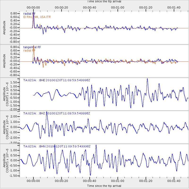
U23A El Rito, NM, USA - Earthquake Result Viewer
*The percent match for this event was below the threshold and hence no stack was calculated.
| Earthquake location: |
Haiti Region |
| Earthquake latitude/longitude: |
18.4/-72.8 |
| Earthquake time(UTC): |
2010/01/20 (020) 11:03:43 GMT |
| Earthquake Depth: |
10 km |
| Earthquake Magnitude: |
5.9 MB, 5.8 MS, 5.9 MW, 5.9 MW |
| Earthquake Catalog/Contributor: |
WHDF/NEIC |
|
| Network: |
TA USArray Transportable Network (new EarthScope stations) |
| Station: |
U23A El Rito, NM, USA |
| Lat/Lon: |
36.33 N/106.19 W |
| Elevation: |
2093 m |
|
| Distance: |
34.4 deg |
| Az: |
308.09 deg |
| Baz: |
112.285 deg |
| Ray Param: |
$rayparam |
*The percent match for this event was below the threshold and hence was not used in the summary stack. |
|
| Radial Match: |
73.92473 % |
| Radial Bump: |
353 |
| Transverse Match: |
52.981026 % |
| Transverse Bump: |
400 |
| SOD ConfigId: |
296938 |
| Insert Time: |
2010-04-06 22:22:24.810 +0000 |
| GWidth: |
2.5 |
| Max Bumps: |
400 |
| Tol: |
0.001 |
|
Signal To Noise
| Channel | StoN | STA | LTA |
| TA:U23A: :BHZ:20100120T11:09:59.549998Z | 2.8329663 | 8.1899464E-7 | 2.8909437E-7 |
| TA:U23A: :BHN:20100120T11:09:59.549998Z | 1.7385604 | 4.0007893E-7 | 2.301208E-7 |
| TA:U23A: :BHE:20100120T11:09:59.549998Z | 1.0771973 | 3.1730124E-7 | 2.9456186E-7 |
| Arrivals |
| Ps | |
| PpPs | |
| PsPs/PpSs | |


