You are here: Home > Network List > TA - USArray Transportable Network (new EarthScope stations) Stations List
> Station X29A Tulia, tX, USA > Earthquake Result Viewer
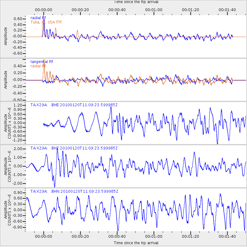
X29A Tulia, tX, USA - Earthquake Result Viewer
*The percent match for this event was below the threshold and hence no stack was calculated.
| Earthquake location: |
Haiti Region |
| Earthquake latitude/longitude: |
18.4/-72.8 |
| Earthquake time(UTC): |
2010/01/20 (020) 11:03:43 GMT |
| Earthquake Depth: |
10 km |
| Earthquake Magnitude: |
5.9 MB, 5.8 MS, 5.9 MW, 5.9 MW |
| Earthquake Catalog/Contributor: |
WHDF/NEIC |
|
| Network: |
TA USArray Transportable Network (new EarthScope stations) |
| Station: |
X29A Tulia, tX, USA |
| Lat/Lon: |
34.45 N/101.70 W |
| Elevation: |
1039 m |
|
| Distance: |
30.2 deg |
| Az: |
307.586 deg |
| Baz: |
114.45 deg |
| Ray Param: |
$rayparam |
*The percent match for this event was below the threshold and hence was not used in the summary stack. |
|
| Radial Match: |
56.686512 % |
| Radial Bump: |
400 |
| Transverse Match: |
59.048904 % |
| Transverse Bump: |
400 |
| SOD ConfigId: |
296938 |
| Insert Time: |
2010-04-06 22:25:50.748 +0000 |
| GWidth: |
2.5 |
| Max Bumps: |
400 |
| Tol: |
0.001 |
|
Signal To Noise
| Channel | StoN | STA | LTA |
| TA:X29A: :BHZ:20100120T11:09:23.599985Z | 3.0468748 | 6.530374E-7 | 2.1433023E-7 |
| TA:X29A: :BHN:20100120T11:09:23.599985Z | 0.99377286 | 3.7602058E-7 | 3.7837677E-7 |
| TA:X29A: :BHE:20100120T11:09:23.599985Z | 1.2691143 | 4.06274E-7 | 3.201241E-7 |
| Arrivals |
| Ps | |
| PpPs | |
| PsPs/PpSs | |


