You are here: Home > Network List > TA - USArray Transportable Network (new EarthScope stations) Stations List
> Station S29A Ulysses, KS, USA > Earthquake Result Viewer
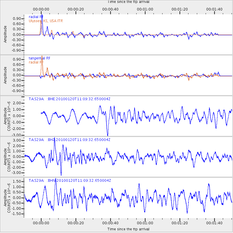
S29A Ulysses, KS, USA - Earthquake Result Viewer
*The percent match for this event was below the threshold and hence no stack was calculated.
| Earthquake location: |
Haiti Region |
| Earthquake latitude/longitude: |
18.4/-72.8 |
| Earthquake time(UTC): |
2010/01/20 (020) 11:03:43 GMT |
| Earthquake Depth: |
10 km |
| Earthquake Magnitude: |
5.9 MB, 5.8 MS, 5.9 MW, 5.9 MW |
| Earthquake Catalog/Contributor: |
WHDF/NEIC |
|
| Network: |
TA USArray Transportable Network (new EarthScope stations) |
| Station: |
S29A Ulysses, KS, USA |
| Lat/Lon: |
37.62 N/101.12 W |
| Elevation: |
931 m |
|
| Distance: |
31.3 deg |
| Az: |
313.522 deg |
| Baz: |
119.893 deg |
| Ray Param: |
$rayparam |
*The percent match for this event was below the threshold and hence was not used in the summary stack. |
|
| Radial Match: |
75.59246 % |
| Radial Bump: |
385 |
| Transverse Match: |
61.99052 % |
| Transverse Bump: |
400 |
| SOD ConfigId: |
296938 |
| Insert Time: |
2010-04-06 22:26:35.639 +0000 |
| GWidth: |
2.5 |
| Max Bumps: |
400 |
| Tol: |
0.001 |
|
Signal To Noise
| Channel | StoN | STA | LTA |
| TA:S29A: :BHZ:20100120T11:09:32.650004Z | 3.1590278 | 8.7386803E-7 | 2.7662563E-7 |
| TA:S29A: :BHN:20100120T11:09:32.650004Z | 2.345591 | 6.432399E-7 | 2.7423363E-7 |
| TA:S29A: :BHE:20100120T11:09:32.650004Z | 1.4489889 | 8.5206665E-7 | 5.880422E-7 |
| Arrivals |
| Ps | |
| PpPs | |
| PsPs/PpSs | |


