You are here: Home > Network List > TA - USArray Transportable Network (new EarthScope stations) Stations List
> Station P30A Selden, KS, USA > Earthquake Result Viewer
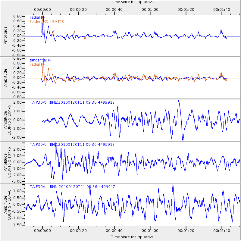
P30A Selden, KS, USA - Earthquake Result Viewer
*The percent match for this event was below the threshold and hence no stack was calculated.
| Earthquake location: |
Haiti Region |
| Earthquake latitude/longitude: |
18.4/-72.8 |
| Earthquake time(UTC): |
2010/01/20 (020) 11:03:43 GMT |
| Earthquake Depth: |
10 km |
| Earthquake Magnitude: |
5.9 MB, 5.8 MS, 5.9 MW, 5.9 MW |
| Earthquake Catalog/Contributor: |
WHDF/NEIC |
|
| Network: |
TA USArray Transportable Network (new EarthScope stations) |
| Station: |
P30A Selden, KS, USA |
| Lat/Lon: |
39.54 N/100.25 W |
| Elevation: |
788 m |
|
| Distance: |
31.7 deg |
| Az: |
317.338 deg |
| Baz: |
123.689 deg |
| Ray Param: |
$rayparam |
*The percent match for this event was below the threshold and hence was not used in the summary stack. |
|
| Radial Match: |
75.74143 % |
| Radial Bump: |
350 |
| Transverse Match: |
54.684273 % |
| Transverse Bump: |
378 |
| SOD ConfigId: |
296938 |
| Insert Time: |
2010-04-06 22:27:05.562 +0000 |
| GWidth: |
2.5 |
| Max Bumps: |
400 |
| Tol: |
0.001 |
|
Signal To Noise
| Channel | StoN | STA | LTA |
| TA:P30A: :BHZ:20100120T11:09:36.449991Z | 1.5895808 | 6.152331E-7 | 3.870411E-7 |
| TA:P30A: :BHN:20100120T11:09:36.449991Z | 0.5059335 | 2.336531E-7 | 4.618257E-7 |
| TA:P30A: :BHE:20100120T11:09:36.449991Z | 1.1829958 | 4.1036355E-7 | 3.4688506E-7 |
| Arrivals |
| Ps | |
| PpPs | |
| PsPs/PpSs | |


