You are here: Home > Network List > US - United States National Seismic Network Stations List
> Station WUAZ Wupatki, Arizona, USA > Earthquake Result Viewer
WUAZ Wupatki, Arizona, USA - Earthquake Result Viewer
*The percent match for this event was below the threshold and hence no stack was calculated.
| Earthquake location: |
Haiti Region |
| Earthquake latitude/longitude: |
18.4/-72.8 |
| Earthquake time(UTC): |
2010/01/20 (020) 11:03:43 GMT |
| Earthquake Depth: |
10 km |
| Earthquake Magnitude: |
5.9 MB, 5.8 MS, 5.9 MW, 5.9 MW |
| Earthquake Catalog/Contributor: |
WHDF/NEIC |
|
| Network: |
US United States National Seismic Network |
| Station: |
WUAZ Wupatki, Arizona, USA |
| Lat/Lon: |
35.52 N/111.37 W |
| Elevation: |
1592 m |
|
| Distance: |
38.1 deg |
| Az: |
304.443 deg |
| Baz: |
106.313 deg |
| Ray Param: |
$rayparam |
*The percent match for this event was below the threshold and hence was not used in the summary stack. |
|
| Radial Match: |
69.24 % |
| Radial Bump: |
400 |
| Transverse Match: |
55.27749 % |
| Transverse Bump: |
400 |
| SOD ConfigId: |
296938 |
| Insert Time: |
2010-04-06 22:30:48.060 +0000 |
| GWidth: |
2.5 |
| Max Bumps: |
400 |
| Tol: |
0.001 |
|
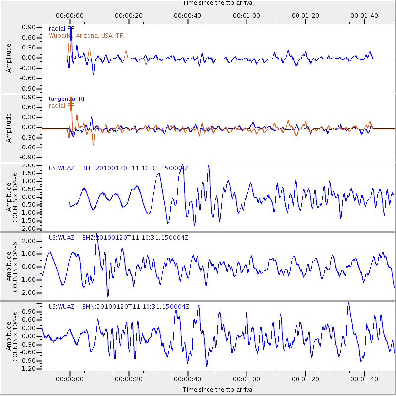
Signal To Noise
| Channel | StoN | STA | LTA |
| US:WUAZ: :BHZ:20100120T11:10:31.150004Z | 1.4916084 | 9.201024E-7 | 6.168525E-7 |
| US:WUAZ: :BHN:20100120T11:10:31.150004Z | 0.3891326 | 1.9038579E-7 | 4.892569E-7 |
| US:WUAZ: :BHE:20100120T11:10:31.150004Z | 2.730389 | 1.1052829E-6 | 4.0480782E-7 |
| Arrivals |
| Ps | |
| PpPs | |
| PsPs/PpSs | |


