You are here: Home > Network List > US - United States National Seismic Network Stations List
> Station HAWA Hanford, Washington, USA > Earthquake Result Viewer
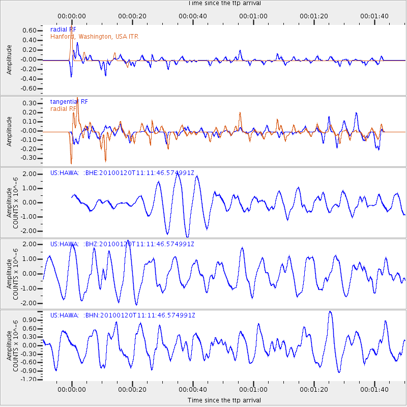
HAWA Hanford, Washington, USA - Earthquake Result Viewer
*The percent match for this event was below the threshold and hence no stack was calculated.
| Earthquake location: |
Haiti Region |
| Earthquake latitude/longitude: |
18.4/-72.8 |
| Earthquake time(UTC): |
2010/01/20 (020) 11:03:43 GMT |
| Earthquake Depth: |
10 km |
| Earthquake Magnitude: |
5.9 MB, 5.8 MS, 5.9 MW, 5.9 MW |
| Earthquake Catalog/Contributor: |
WHDF/NEIC |
|
| Network: |
US United States National Seismic Network |
| Station: |
HAWA Hanford, Washington, USA |
| Lat/Lon: |
46.39 N/119.53 W |
| Elevation: |
364 m |
|
| Distance: |
47.4 deg |
| Az: |
316.782 deg |
| Baz: |
110.067 deg |
| Ray Param: |
$rayparam |
*The percent match for this event was below the threshold and hence was not used in the summary stack. |
|
| Radial Match: |
66.7502 % |
| Radial Bump: |
400 |
| Transverse Match: |
63.539284 % |
| Transverse Bump: |
400 |
| SOD ConfigId: |
296938 |
| Insert Time: |
2010-04-06 22:31:02.339 +0000 |
| GWidth: |
2.5 |
| Max Bumps: |
400 |
| Tol: |
0.001 |
|
Signal To Noise
| Channel | StoN | STA | LTA |
| US:HAWA: :BHZ:20100120T11:11:46.574991Z | 2.0735886 | 1.4510441E-6 | 6.997743E-7 |
| US:HAWA: :BHN:20100120T11:11:46.574991Z | 0.51280755 | 3.0874213E-7 | 6.0206236E-7 |
| US:HAWA: :BHE:20100120T11:11:46.574991Z | 4.895537 | 1.3596818E-6 | 2.7773908E-7 |
| Arrivals |
| Ps | |
| PpPs | |
| PsPs/PpSs | |


