You are here: Home > Network List > NE - New England Seismic Network Stations List
> Station EMMW Machias, ME, USA > Earthquake Result Viewer
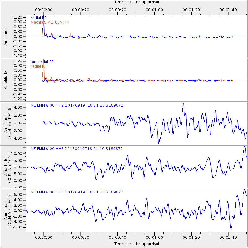
EMMW Machias, ME, USA - Earthquake Result Viewer

| Earthquake location: |
Central Mexico |
| Earthquake latitude/longitude: |
18.6/-98.5 |
| Earthquake time(UTC): |
2017/09/19 (262) 18:14:38 GMT |
| Earthquake Depth: |
51 km |
| Earthquake Magnitude: |
7.1 Mww |
| Earthquake Catalog/Contributor: |
NEIC PDE/us |
|
| Network: |
NE New England Seismic Network |
| Station: |
EMMW Machias, ME, USA |
| Lat/Lon: |
44.71 N/67.46 W |
| Elevation: |
35 m |
|
| Distance: |
36.7 deg |
| Az: |
37.924 deg |
| Baz: |
234.854 deg |
| Ray Param: |
0.076386936 |
| Estimated Moho Depth: |
57.5 km |
| Estimated Crust Vp/Vs: |
1.95 |
| Assumed Crust Vp: |
6.419 km/s |
| Estimated Crust Vs: |
3.288 km/s |
| Estimated Crust Poisson's Ratio: |
0.32 |
|
| Radial Match: |
92.69459 % |
| Radial Bump: |
196 |
| Transverse Match: |
70.28926 % |
| Transverse Bump: |
400 |
| SOD ConfigId: |
2973751 |
| Insert Time: |
2018-10-08 23:01:25.755 +0000 |
| GWidth: |
2.5 |
| Max Bumps: |
400 |
| Tol: |
0.001 |
|
Signal To Noise
| Channel | StoN | STA | LTA |
| NE:EMMW:00:HHZ:20170919T18:21:10.318987Z | 5.5912356 | 1.9298693E-6 | 3.4515972E-7 |
| NE:EMMW:00:HH1:20170919T18:21:10.318987Z | 3.2048163 | 8.420496E-7 | 2.6274503E-7 |
| NE:EMMW:00:HH2:20170919T18:21:10.318987Z | 3.5917616 | 1.1828814E-6 | 3.293318E-7 |
| Arrivals |
| Ps | 9.1 SECOND |
| PpPs | 25 SECOND |
| PsPs/PpSs | 34 SECOND |


