You are here: Home > Network List > TA - USArray Transportable Network (new EarthScope stations) Stations List
> Station H28A Mission Ridge, SD, USA > Earthquake Result Viewer
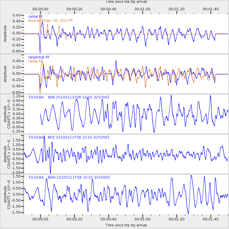
H28A Mission Ridge, SD, USA - Earthquake Result Viewer
*The percent match for this event was below the threshold and hence no stack was calculated.
| Earthquake location: |
East Central Pacific Ocean |
| Earthquake latitude/longitude: |
8.3/-110.4 |
| Earthquake time(UTC): |
2010/01/21 (021) 08:03:22 GMT |
| Earthquake Depth: |
10 km |
| Earthquake Magnitude: |
5.8 MB, 5.3 MS, 5.6 MW, 5.6 MW |
| Earthquake Catalog/Contributor: |
WHDF/NEIC |
|
| Network: |
TA USArray Transportable Network (new EarthScope stations) |
| Station: |
H28A Mission Ridge, SD, USA |
| Lat/Lon: |
44.68 N/101.02 W |
| Elevation: |
642 m |
|
| Distance: |
37.2 deg |
| Az: |
11.048 deg |
| Baz: |
195.417 deg |
| Ray Param: |
$rayparam |
*The percent match for this event was below the threshold and hence was not used in the summary stack. |
|
| Radial Match: |
50.606358 % |
| Radial Bump: |
400 |
| Transverse Match: |
48.409264 % |
| Transverse Bump: |
394 |
| SOD ConfigId: |
296938 |
| Insert Time: |
2010-04-06 22:45:26.585 +0000 |
| GWidth: |
2.5 |
| Max Bumps: |
400 |
| Tol: |
0.001 |
|
Signal To Noise
| Channel | StoN | STA | LTA |
| TA:H28A: :BHZ:20100121T08:10:02.925006Z | 3.1726322 | 7.512059E-7 | 2.3677686E-7 |
| TA:H28A: :BHN:20100121T08:10:02.925006Z | 1.3137692 | 6.932252E-7 | 5.2766137E-7 |
| TA:H28A: :BHE:20100121T08:10:02.925006Z | 0.6821113 | 3.6247323E-7 | 5.313989E-7 |
| Arrivals |
| Ps | |
| PpPs | |
| PsPs/PpSs | |


