You are here: Home > Network List > US - United States National Seismic Network Stations List
> Station AMTX Amarillo, Texas, USA > Earthquake Result Viewer
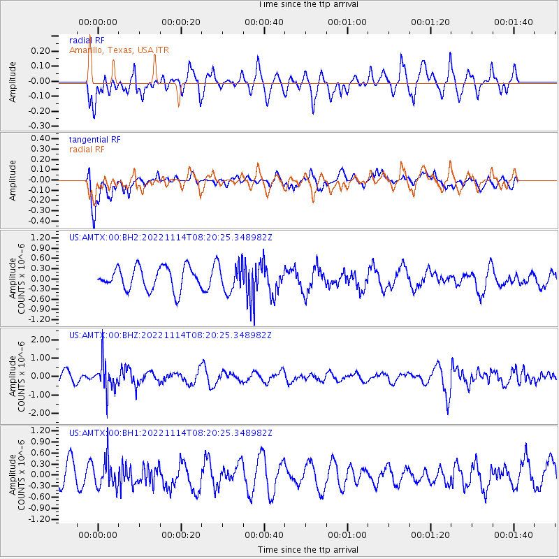
AMTX Amarillo, Texas, USA - Earthquake Result Viewer
*The percent match for this event was below the threshold and hence no stack was calculated.
| Earthquake location: |
Near S. Coast Of Honshu, Japan |
| Earthquake latitude/longitude: |
33.8/137.3 |
| Earthquake time(UTC): |
2022/11/14 (318) 08:08:26 GMT |
| Earthquake Depth: |
357 km |
| Earthquake Magnitude: |
6.1 mww |
| Earthquake Catalog/Contributor: |
NEIC PDE/us |
|
| Network: |
US United States National Seismic Network |
| Station: |
AMTX Amarillo, Texas, USA |
| Lat/Lon: |
34.53 N/101.41 W |
| Elevation: |
1010 m |
|
| Distance: |
92.6 deg |
| Az: |
44.901 deg |
| Baz: |
314.607 deg |
| Ray Param: |
$rayparam |
*The percent match for this event was below the threshold and hence was not used in the summary stack. |
|
| Radial Match: |
50.315563 % |
| Radial Bump: |
400 |
| Transverse Match: |
47.646793 % |
| Transverse Bump: |
400 |
| SOD ConfigId: |
29823551 |
| Insert Time: |
2022-11-28 08:43:07.178 +0000 |
| GWidth: |
2.5 |
| Max Bumps: |
400 |
| Tol: |
0.001 |
|
Signal To Noise
| Channel | StoN | STA | LTA |
| US:AMTX:00:BHZ:20221114T08:20:25.348982Z | 2.8725853 | 7.9351946E-7 | 2.7623878E-7 |
| US:AMTX:00:BH1:20221114T08:20:25.348982Z | 1.1387315 | 3.903203E-7 | 3.4276766E-7 |
| US:AMTX:00:BH2:20221114T08:20:25.348982Z | 1.2807214 | 4.422691E-7 | 3.4532812E-7 |
| Arrivals |
| Ps | |
| PpPs | |
| PsPs/PpSs | |


