You are here: Home > Network List > US - United States National Seismic Network Stations List
> Station DGMT Dagmar, Montana, USA > Earthquake Result Viewer
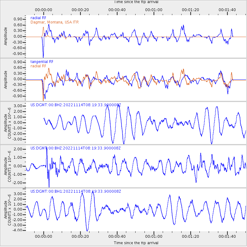
DGMT Dagmar, Montana, USA - Earthquake Result Viewer
*The percent match for this event was below the threshold and hence no stack was calculated.
| Earthquake location: |
Near S. Coast Of Honshu, Japan |
| Earthquake latitude/longitude: |
33.8/137.3 |
| Earthquake time(UTC): |
2022/11/14 (318) 08:08:26 GMT |
| Earthquake Depth: |
357 km |
| Earthquake Magnitude: |
6.1 mww |
| Earthquake Catalog/Contributor: |
NEIC PDE/us |
|
| Network: |
US United States National Seismic Network |
| Station: |
DGMT Dagmar, Montana, USA |
| Lat/Lon: |
48.47 N/104.20 W |
| Elevation: |
646 m |
|
| Distance: |
81.5 deg |
| Az: |
36.237 deg |
| Baz: |
312.3 deg |
| Ray Param: |
$rayparam |
*The percent match for this event was below the threshold and hence was not used in the summary stack. |
|
| Radial Match: |
56.649998 % |
| Radial Bump: |
400 |
| Transverse Match: |
41.25982 % |
| Transverse Bump: |
400 |
| SOD ConfigId: |
29823551 |
| Insert Time: |
2022-11-28 08:43:13.233 +0000 |
| GWidth: |
2.5 |
| Max Bumps: |
400 |
| Tol: |
0.001 |
|
Signal To Noise
| Channel | StoN | STA | LTA |
| US:DGMT:00:BHZ:20221114T08:19:33.900008Z | 2.6281114 | 8.979018E-7 | 3.4165288E-7 |
| US:DGMT:00:BH1:20221114T08:19:33.900008Z | 1.3753043 | 1.3603759E-6 | 9.891454E-7 |
| US:DGMT:00:BH2:20221114T08:19:33.900008Z | 2.0282702 | 1.7993004E-6 | 8.871108E-7 |
| Arrivals |
| Ps | |
| PpPs | |
| PsPs/PpSs | |


