You are here: Home > Network List > US - United States National Seismic Network Stations List
> Station DUG Dugway, Tooele County, Utah, USA > Earthquake Result Viewer
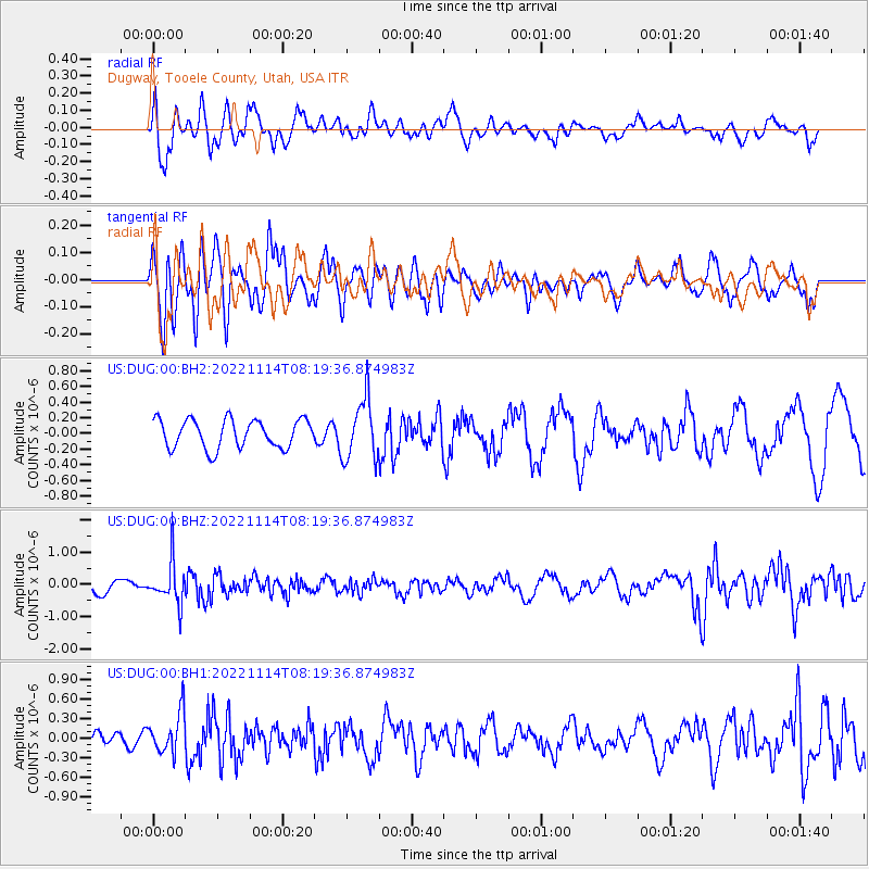
DUG Dugway, Tooele County, Utah, USA - Earthquake Result Viewer
*The percent match for this event was below the threshold and hence no stack was calculated.
| Earthquake location: |
Near S. Coast Of Honshu, Japan |
| Earthquake latitude/longitude: |
33.8/137.3 |
| Earthquake time(UTC): |
2022/11/14 (318) 08:08:26 GMT |
| Earthquake Depth: |
357 km |
| Earthquake Magnitude: |
6.1 mww |
| Earthquake Catalog/Contributor: |
NEIC PDE/us |
|
| Network: |
US United States National Seismic Network |
| Station: |
DUG Dugway, Tooele County, Utah, USA |
| Lat/Lon: |
40.19 N/112.81 W |
| Elevation: |
1477 m |
|
| Distance: |
82.0 deg |
| Az: |
46.645 deg |
| Baz: |
307.774 deg |
| Ray Param: |
$rayparam |
*The percent match for this event was below the threshold and hence was not used in the summary stack. |
|
| Radial Match: |
64.94762 % |
| Radial Bump: |
400 |
| Transverse Match: |
57.80904 % |
| Transverse Bump: |
400 |
| SOD ConfigId: |
29823551 |
| Insert Time: |
2022-11-28 08:43:16.786 +0000 |
| GWidth: |
2.5 |
| Max Bumps: |
400 |
| Tol: |
0.001 |
|
Signal To Noise
| Channel | StoN | STA | LTA |
| US:DUG:00:BHZ:20221114T08:19:36.874983Z | 2.2322736 | 6.4238236E-7 | 2.8777043E-7 |
| US:DUG:00:BH1:20221114T08:19:36.874983Z | 1.3263711 | 3.0961746E-7 | 2.33432E-7 |
| US:DUG:00:BH2:20221114T08:19:36.874983Z | 2.1180239 | 3.84881E-7 | 1.8171703E-7 |
| Arrivals |
| Ps | |
| PpPs | |
| PsPs/PpSs | |


