You are here: Home > Network List > GT - Global Telemetered Seismograph Network (USAF/USGS) Stations List
> Station PLCA Paso Flores, Argentina > Earthquake Result Viewer
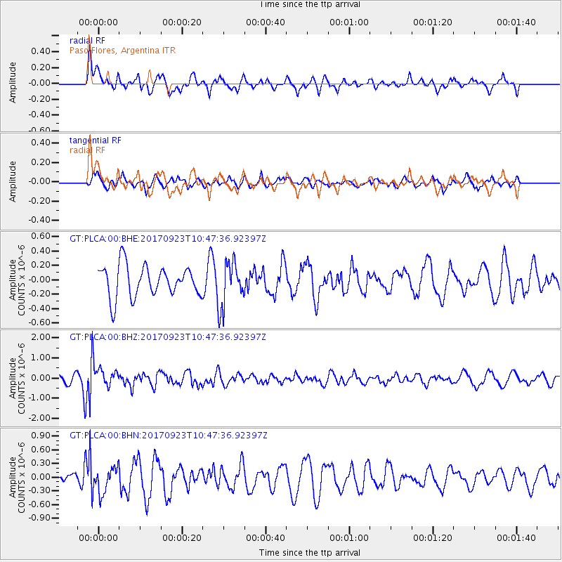
PLCA Paso Flores, Argentina - Earthquake Result Viewer
*The percent match for this event was below the threshold and hence no stack was calculated.
| Earthquake location: |
Near Coast Of Oaxaca, Mexico |
| Earthquake latitude/longitude: |
15.7/-94.2 |
| Earthquake time(UTC): |
2017/09/23 (266) 10:38:08 GMT |
| Earthquake Depth: |
74 km |
| Earthquake Magnitude: |
5.8 Mww |
| Earthquake Catalog/Contributor: |
NEIC PDE/us |
|
| Network: |
GT Global Telemetered Seismograph Network (USAF/USGS) |
| Station: |
PLCA Paso Flores, Argentina |
| Lat/Lon: |
40.73 S/70.55 W |
| Elevation: |
1050 m |
|
| Distance: |
60.3 deg |
| Az: |
159.482 deg |
| Baz: |
333.624 deg |
| Ray Param: |
$rayparam |
*The percent match for this event was below the threshold and hence was not used in the summary stack. |
|
| Radial Match: |
67.34889 % |
| Radial Bump: |
388 |
| Transverse Match: |
40.47205 % |
| Transverse Bump: |
373 |
| SOD ConfigId: |
2973751 |
| Insert Time: |
2018-10-08 23:20:39.210 +0000 |
| GWidth: |
2.5 |
| Max Bumps: |
400 |
| Tol: |
0.001 |
|
Signal To Noise
| Channel | StoN | STA | LTA |
| GT:PLCA:00:BHZ:20170923T10:47:36.92397Z | 2.3059394 | 3.7444994E-7 | 1.6238498E-7 |
| GT:PLCA:00:BHN:20170923T10:47:36.92397Z | 2.103867 | 2.8020702E-7 | 1.3318666E-7 |
| GT:PLCA:00:BHE:20170923T10:47:36.92397Z | 0.78523475 | 1.7985705E-7 | 2.2904877E-7 |
| Arrivals |
| Ps | |
| PpPs | |
| PsPs/PpSs | |


