You are here: Home > Network List > IU - Global Seismograph Network (GSN - IRIS/USGS) Stations List
> Station POHA Pohakuloa, Hawaii, USA > Earthquake Result Viewer
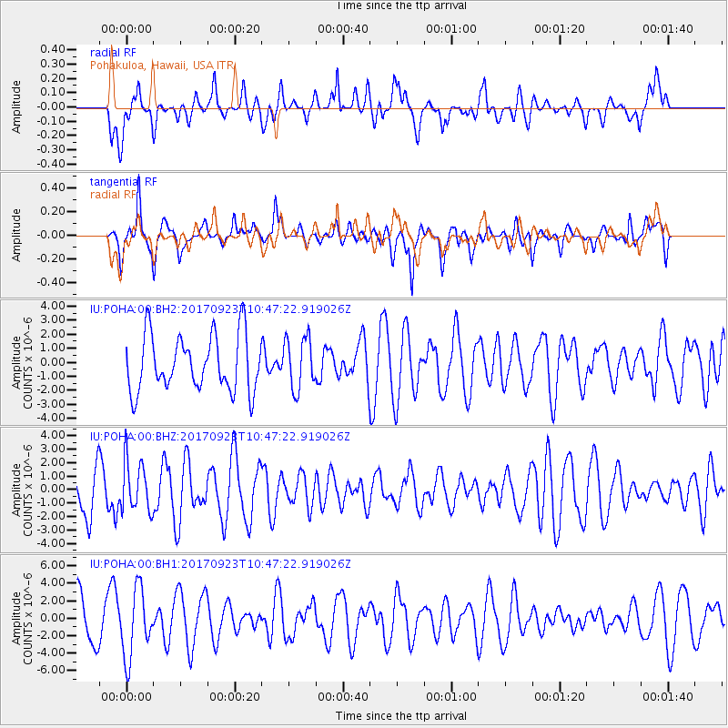
POHA Pohakuloa, Hawaii, USA - Earthquake Result Viewer
*The percent match for this event was below the threshold and hence no stack was calculated.
| Earthquake location: |
Near Coast Of Oaxaca, Mexico |
| Earthquake latitude/longitude: |
15.7/-94.2 |
| Earthquake time(UTC): |
2017/09/23 (266) 10:38:08 GMT |
| Earthquake Depth: |
74 km |
| Earthquake Magnitude: |
5.8 Mww |
| Earthquake Catalog/Contributor: |
NEIC PDE/us |
|
| Network: |
IU Global Seismograph Network (GSN - IRIS/USGS) |
| Station: |
POHA Pohakuloa, Hawaii, USA |
| Lat/Lon: |
19.76 N/155.53 W |
| Elevation: |
1990 m |
|
| Distance: |
58.3 deg |
| Az: |
283.751 deg |
| Baz: |
83.376 deg |
| Ray Param: |
$rayparam |
*The percent match for this event was below the threshold and hence was not used in the summary stack. |
|
| Radial Match: |
38.34533 % |
| Radial Bump: |
400 |
| Transverse Match: |
59.96798 % |
| Transverse Bump: |
400 |
| SOD ConfigId: |
2973751 |
| Insert Time: |
2018-10-08 23:20:55.884 +0000 |
| GWidth: |
2.5 |
| Max Bumps: |
400 |
| Tol: |
0.001 |
|
Signal To Noise
| Channel | StoN | STA | LTA |
| IU:POHA:00:BHZ:20170923T10:47:22.919026Z | 1.032329 | 1.9068643E-6 | 1.847148E-6 |
| IU:POHA:00:BH1:20170923T10:47:22.919026Z | 1.6942447 | 3.9418087E-6 | 2.3265875E-6 |
| IU:POHA:00:BH2:20170923T10:47:22.919026Z | 0.80590373 | 1.4883144E-6 | 1.8467645E-6 |
| Arrivals |
| Ps | |
| PpPs | |
| PsPs/PpSs | |


