You are here: Home > Network List > US - United States National Seismic Network Stations List
> Station TZTN Tazewell, Tennessee, USA > Earthquake Result Viewer
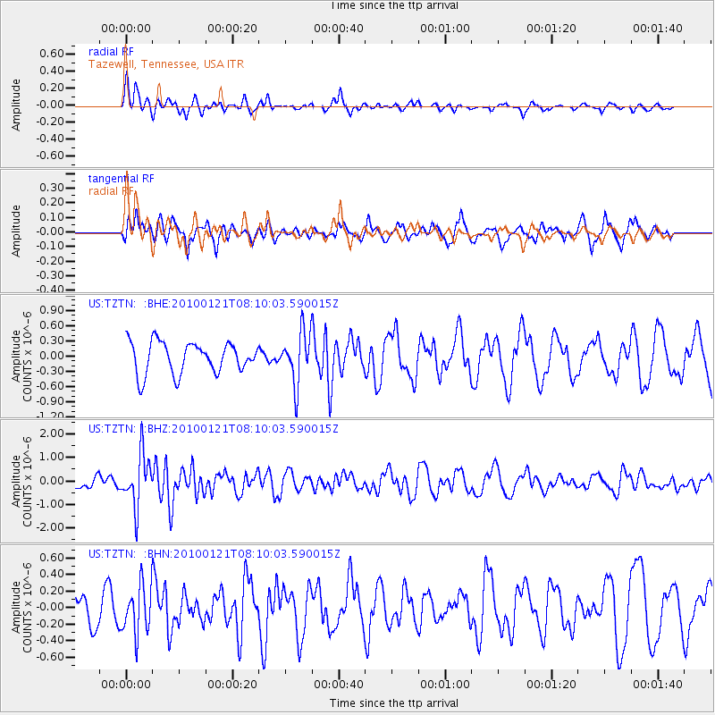
TZTN Tazewell, Tennessee, USA - Earthquake Result Viewer
*The percent match for this event was below the threshold and hence no stack was calculated.
| Earthquake location: |
East Central Pacific Ocean |
| Earthquake latitude/longitude: |
8.3/-110.4 |
| Earthquake time(UTC): |
2010/01/21 (021) 08:03:22 GMT |
| Earthquake Depth: |
10 km |
| Earthquake Magnitude: |
5.8 MB, 5.3 MS, 5.6 MW, 5.6 MW |
| Earthquake Catalog/Contributor: |
WHDF/NEIC |
|
| Network: |
US United States National Seismic Network |
| Station: |
TZTN Tazewell, Tennessee, USA |
| Lat/Lon: |
36.54 N/83.55 W |
| Elevation: |
394 m |
|
| Distance: |
37.2 deg |
| Az: |
36.88 deg |
| Baz: |
227.526 deg |
| Ray Param: |
$rayparam |
*The percent match for this event was below the threshold and hence was not used in the summary stack. |
|
| Radial Match: |
73.424484 % |
| Radial Bump: |
368 |
| Transverse Match: |
53.600487 % |
| Transverse Bump: |
400 |
| SOD ConfigId: |
296938 |
| Insert Time: |
2010-04-06 22:52:26.048 +0000 |
| GWidth: |
2.5 |
| Max Bumps: |
400 |
| Tol: |
0.001 |
|
Signal To Noise
| Channel | StoN | STA | LTA |
| US:TZTN: :BHZ:20100121T08:10:03.590015Z | 2.3290637 | 1.1011167E-6 | 4.7277226E-7 |
| US:TZTN: :BHN:20100121T08:10:03.590015Z | 1.6244607 | 2.89368E-7 | 1.7813171E-7 |
| US:TZTN: :BHE:20100121T08:10:03.590015Z | 1.6613007 | 5.122914E-7 | 3.0836767E-7 |
| Arrivals |
| Ps | |
| PpPs | |
| PsPs/PpSs | |


