You are here: Home > Network List > TA - USArray Transportable Network (new EarthScope stations) Stations List
> Station L02D Cave Junction, OR, USA > Earthquake Result Viewer
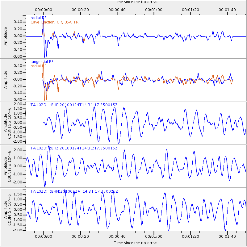
L02D Cave Junction, OR, USA - Earthquake Result Viewer
*The percent match for this event was below the threshold and hence no stack was calculated.
| Earthquake location: |
Solomon Islands |
| Earthquake latitude/longitude: |
-9.2/157.8 |
| Earthquake time(UTC): |
2010/01/24 (024) 14:18:59 GMT |
| Earthquake Depth: |
10 km |
| Earthquake Magnitude: |
5.6 MB, 5.2 MS, 5.5 MW |
| Earthquake Catalog/Contributor: |
WHDF/NEIC |
|
| Network: |
TA USArray Transportable Network (new EarthScope stations) |
| Station: |
L02D Cave Junction, OR, USA |
| Lat/Lon: |
42.16 N/123.60 W |
| Elevation: |
458 m |
|
| Distance: |
87.8 deg |
| Az: |
46.846 deg |
| Baz: |
255.637 deg |
| Ray Param: |
$rayparam |
*The percent match for this event was below the threshold and hence was not used in the summary stack. |
|
| Radial Match: |
78.28417 % |
| Radial Bump: |
400 |
| Transverse Match: |
35.525623 % |
| Transverse Bump: |
292 |
| SOD ConfigId: |
296938 |
| Insert Time: |
2010-04-06 22:58:50.923 +0000 |
| GWidth: |
2.5 |
| Max Bumps: |
400 |
| Tol: |
0.001 |
|
Signal To Noise
| Channel | StoN | STA | LTA |
| TA:L02D: :BHZ:20100124T14:31:17.350015Z | 1.7674438 | 1.6302365E-6 | 9.223697E-7 |
| TA:L02D: :BHN:20100124T14:31:17.350015Z | 0.38105655 | 2.7435416E-7 | 7.1998284E-7 |
| TA:L02D: :BHE:20100124T14:31:17.350015Z | 1.8241224 | 1.1899668E-6 | 6.523503E-7 |
| Arrivals |
| Ps | |
| PpPs | |
| PsPs/PpSs | |


