You are here: Home > Network List > AZ - ANZA Regional Network Stations List
> Station SMER AZ.SMER > Earthquake Result Viewer
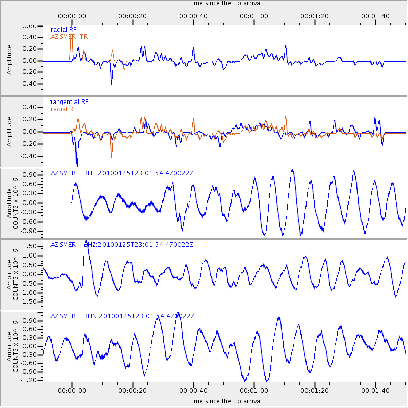
SMER AZ.SMER - Earthquake Result Viewer
*The percent match for this event was below the threshold and hence no stack was calculated.
| Earthquake location: |
Peru-Brazil Border Region |
| Earthquake latitude/longitude: |
-8.5/-74.5 |
| Earthquake time(UTC): |
2010/01/25 (025) 22:52:46 GMT |
| Earthquake Depth: |
147 km |
| Earthquake Magnitude: |
5.7 MB, 5.9 MW, 5.9 MW |
| Earthquake Catalog/Contributor: |
WHDF/NEIC |
|
| Network: |
AZ ANZA Regional Network |
| Station: |
SMER AZ.SMER |
| Lat/Lon: |
33.46 N/117.17 W |
| Elevation: |
355 m |
|
| Distance: |
58.2 deg |
| Az: |
318.148 deg |
| Baz: |
127.865 deg |
| Ray Param: |
$rayparam |
*The percent match for this event was below the threshold and hence was not used in the summary stack. |
|
| Radial Match: |
45.91379 % |
| Radial Bump: |
400 |
| Transverse Match: |
64.77475 % |
| Transverse Bump: |
400 |
| SOD ConfigId: |
296938 |
| Insert Time: |
2010-04-06 23:12:38.167 +0000 |
| GWidth: |
2.5 |
| Max Bumps: |
400 |
| Tol: |
0.001 |
|
Signal To Noise
| Channel | StoN | STA | LTA |
| AZ:SMER: :BHZ:20100125T23:01:54.470022Z | 2.3199615 | 8.7677097E-7 | 3.7792475E-7 |
| AZ:SMER: :BHN:20100125T23:01:54.470022Z | 0.86735296 | 3.3828468E-7 | 3.9001964E-7 |
| AZ:SMER: :BHE:20100125T23:01:54.470022Z | 1.6747563 | 4.178705E-7 | 2.4951123E-7 |
| Arrivals |
| Ps | |
| PpPs | |
| PsPs/PpSs | |


