You are here: Home > Network List > US - United States National Seismic Network Stations List
> Station HAWA Hanford, Washington, USA > Earthquake Result Viewer
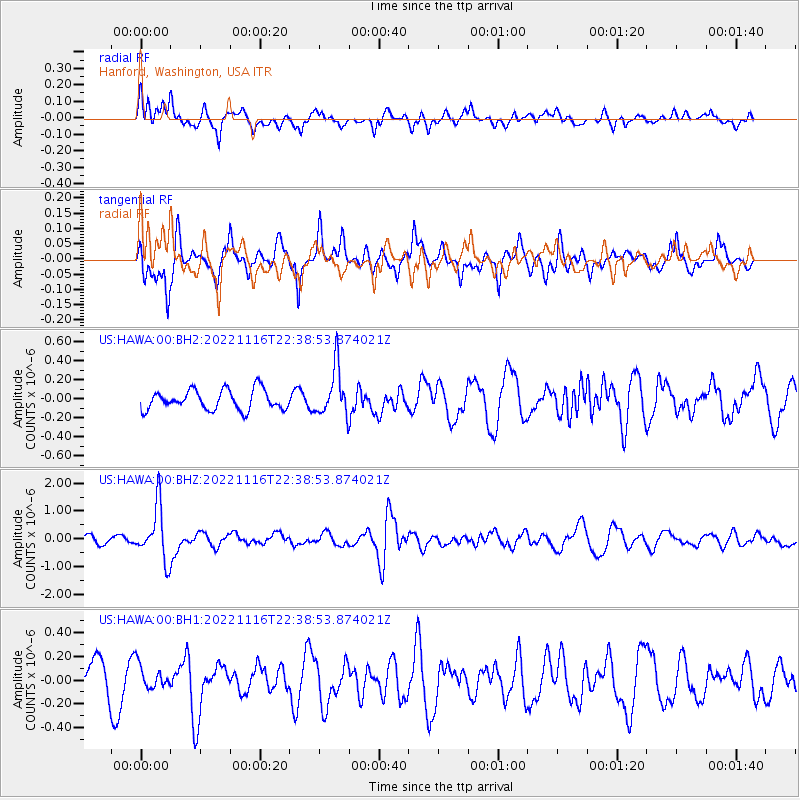
HAWA Hanford, Washington, USA - Earthquake Result Viewer
*The percent match for this event was below the threshold and hence no stack was calculated.
| Earthquake location: |
Santa Cruz Islands |
| Earthquake latitude/longitude: |
-11.7/166.6 |
| Earthquake time(UTC): |
2022/11/16 (320) 22:26:52 GMT |
| Earthquake Depth: |
138 km |
| Earthquake Magnitude: |
5.8 mww |
| Earthquake Catalog/Contributor: |
NEIC PDE/us |
|
| Network: |
US United States National Seismic Network |
| Station: |
HAWA Hanford, Washington, USA |
| Lat/Lon: |
46.39 N/119.53 W |
| Elevation: |
364 m |
|
| Distance: |
87.5 deg |
| Az: |
41.716 deg |
| Baz: |
250.324 deg |
| Ray Param: |
$rayparam |
*The percent match for this event was below the threshold and hence was not used in the summary stack. |
|
| Radial Match: |
75.13693 % |
| Radial Bump: |
400 |
| Transverse Match: |
64.97059 % |
| Transverse Bump: |
366 |
| SOD ConfigId: |
29823551 |
| Insert Time: |
2022-11-30 22:54:45.294 +0000 |
| GWidth: |
2.5 |
| Max Bumps: |
400 |
| Tol: |
0.001 |
|
Signal To Noise
| Channel | StoN | STA | LTA |
| US:HAWA:00:BHZ:20221116T22:38:53.874021Z | 6.288698 | 9.608412E-7 | 1.5278857E-7 |
| US:HAWA:00:BH1:20221116T22:38:53.874021Z | 0.5753779 | 9.65597E-8 | 1.6781962E-7 |
| US:HAWA:00:BH2:20221116T22:38:53.874021Z | 2.4262247 | 2.535608E-7 | 1.0450838E-7 |
| Arrivals |
| Ps | |
| PpPs | |
| PsPs/PpSs | |


