You are here: Home > Network List > G - GEOSCOPE Stations List
> Station INU Inuyama, Japan > Earthquake Result Viewer
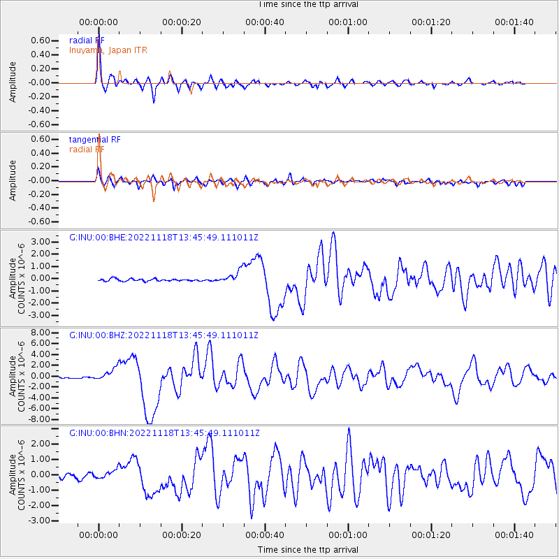
INU Inuyama, Japan - Earthquake Result Viewer

| Earthquake location: |
Southwest Of Sumatra, Indonesia |
| Earthquake latitude/longitude: |
-4.9/100.8 |
| Earthquake time(UTC): |
2022/11/18 (322) 13:37:08 GMT |
| Earthquake Depth: |
25 km |
| Earthquake Magnitude: |
6.9 mww |
| Earthquake Catalog/Contributor: |
NEIC PDE/us |
|
| Network: |
G GEOSCOPE |
| Station: |
INU Inuyama, Japan |
| Lat/Lon: |
35.35 N/137.03 E |
| Elevation: |
132 m |
|
| Distance: |
52.6 deg |
| Az: |
37.497 deg |
| Baz: |
227.899 deg |
| Ray Param: |
0.06664552 |
| Estimated Moho Depth: |
21.5 km |
| Estimated Crust Vp/Vs: |
2.07 |
| Assumed Crust Vp: |
6.461 km/s |
| Estimated Crust Vs: |
3.125 km/s |
| Estimated Crust Poisson's Ratio: |
0.35 |
|
| Radial Match: |
95.91237 % |
| Radial Bump: |
397 |
| Transverse Match: |
87.084496 % |
| Transverse Bump: |
400 |
| SOD ConfigId: |
29823551 |
| Insert Time: |
2022-12-02 13:40:43.734 +0000 |
| GWidth: |
2.5 |
| Max Bumps: |
400 |
| Tol: |
0.001 |
|
Signal To Noise
| Channel | StoN | STA | LTA |
| G:INU:00:BHZ:20221118T13:45:49.111011Z | 10.432656 | 1.2519397E-6 | 1.2000201E-7 |
| G:INU:00:BHN:20221118T13:45:49.111011Z | 2.8781853 | 3.0945313E-7 | 1.0751675E-7 |
| G:INU:00:BHE:20221118T13:45:49.111011Z | 6.160406 | 5.697081E-7 | 9.2478984E-8 |
| Arrivals |
| Ps | 3.7 SECOND |
| PpPs | 9.7 SECOND |
| PsPs/PpSs | 13 SECOND |


