You are here: Home > Network List > TA - USArray Transportable Network (new EarthScope stations) Stations List
> Station 431A Sonora, TX, USA > Earthquake Result Viewer
431A Sonora, TX, USA - Earthquake Result Viewer
*The percent match for this event was below the threshold and hence no stack was calculated.
| Earthquake location: |
Peru-Brazil Border Region |
| Earthquake latitude/longitude: |
-8.5/-74.5 |
| Earthquake time(UTC): |
2010/01/25 (025) 22:52:46 GMT |
| Earthquake Depth: |
147 km |
| Earthquake Magnitude: |
5.7 MB, 5.9 MW, 5.9 MW |
| Earthquake Catalog/Contributor: |
WHDF/NEIC |
|
| Network: |
TA USArray Transportable Network (new EarthScope stations) |
| Station: |
431A Sonora, TX, USA |
| Lat/Lon: |
30.68 N/100.61 W |
| Elevation: |
700 m |
|
| Distance: |
46.3 deg |
| Az: |
328.35 deg |
| Baz: |
142.952 deg |
| Ray Param: |
$rayparam |
*The percent match for this event was below the threshold and hence was not used in the summary stack. |
|
| Radial Match: |
59.029507 % |
| Radial Bump: |
400 |
| Transverse Match: |
71.41161 % |
| Transverse Bump: |
400 |
| SOD ConfigId: |
296938 |
| Insert Time: |
2010-04-06 23:36:20.193 +0000 |
| GWidth: |
2.5 |
| Max Bumps: |
400 |
| Tol: |
0.001 |
|
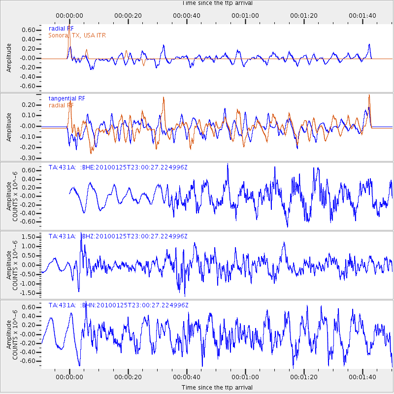
Signal To Noise
| Channel | StoN | STA | LTA |
| TA:431A: :BHZ:20100125T23:00:27.224996Z | 3.2307224 | 6.401731E-7 | 1.981517E-7 |
| TA:431A: :BHN:20100125T23:00:27.224996Z | 1.2947878 | 3.579684E-7 | 2.764688E-7 |
| TA:431A: :BHE:20100125T23:00:27.224996Z | 1.059106 | 1.8486301E-7 | 1.7454627E-7 |
| Arrivals |
| Ps | |
| PpPs | |
| PsPs/PpSs | |


