
MM12 Laura, Ohio - Earthquake Result Viewer
| ||||||||||||||||||
| ||||||||||||||||||
| ||||||||||||||||||
|
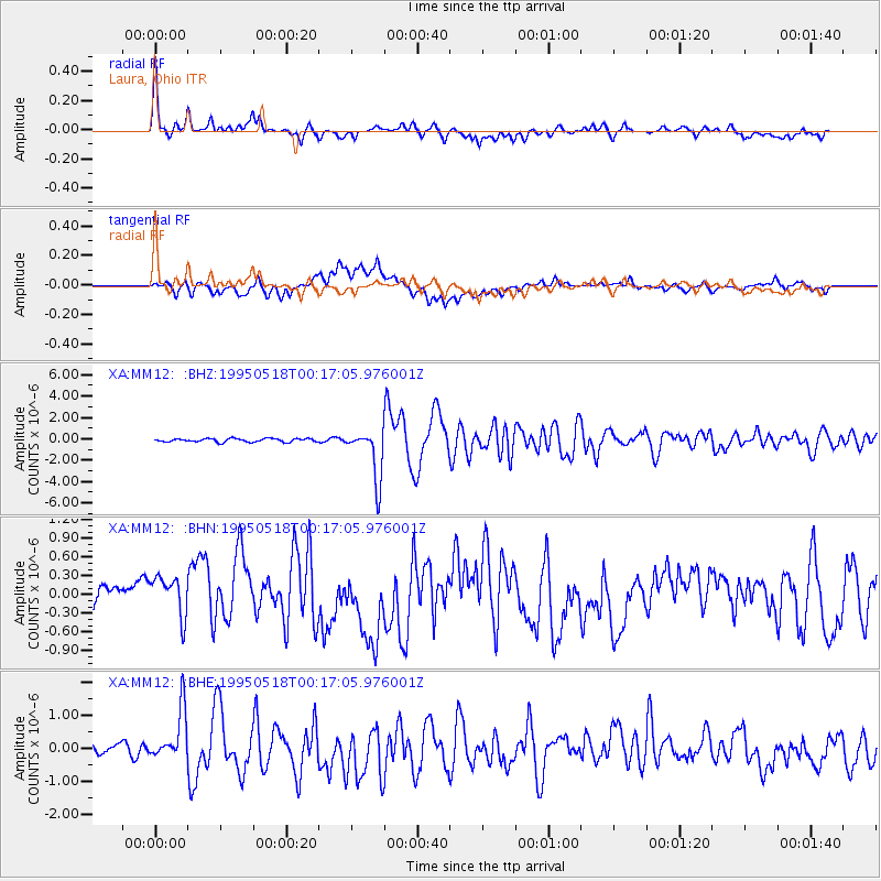
Signal To Noise
| Channel | StoN | STA | LTA |
| XA:MM12: :BHN:19950518T00:17:05.976001Z | 2.3204641 | 4.0041377E-7 | 1.7255762E-7 |
| XA:MM12: :BHE:19950518T00:17:05.976001Z | 5.679243 | 8.0377794E-7 | 1.4152906E-7 |
| XA:MM12: :BHZ:19950518T00:17:05.976001Z | 15.469818 | 2.403317E-6 | 1.5535522E-7 |
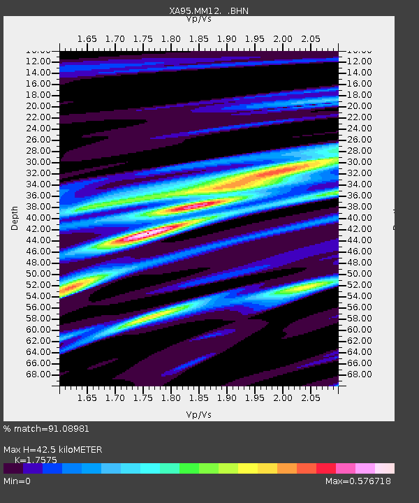
| Arrivals | |
| Ps | 5.1 SECOND |
| PpPs | 17 SECOND |
| PsPs/PpSs | 23 SECOND |

