You are here: Home > Network List > US - United States National Seismic Network Stations List
> Station WMOK Wichita Mountains, Oklahoma, USA > Earthquake Result Viewer
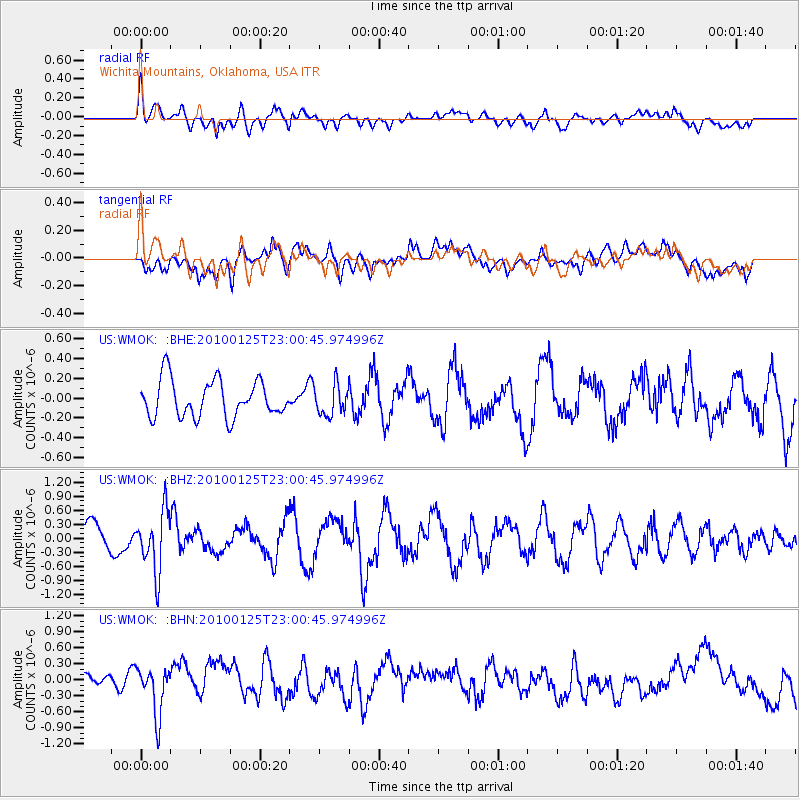
WMOK Wichita Mountains, Oklahoma, USA - Earthquake Result Viewer
*The percent match for this event was below the threshold and hence no stack was calculated.
| Earthquake location: |
Peru-Brazil Border Region |
| Earthquake latitude/longitude: |
-8.5/-74.5 |
| Earthquake time(UTC): |
2010/01/25 (025) 22:52:46 GMT |
| Earthquake Depth: |
147 km |
| Earthquake Magnitude: |
5.7 MB, 5.9 MW, 5.9 MW |
| Earthquake Catalog/Contributor: |
WHDF/NEIC |
|
| Network: |
US United States National Seismic Network |
| Station: |
WMOK Wichita Mountains, Oklahoma, USA |
| Lat/Lon: |
34.74 N/98.78 W |
| Elevation: |
486 m |
|
| Distance: |
48.8 deg |
| Az: |
333.199 deg |
| Baz: |
147.21 deg |
| Ray Param: |
$rayparam |
*The percent match for this event was below the threshold and hence was not used in the summary stack. |
|
| Radial Match: |
55.920094 % |
| Radial Bump: |
400 |
| Transverse Match: |
50.642864 % |
| Transverse Bump: |
400 |
| SOD ConfigId: |
296938 |
| Insert Time: |
2010-04-06 23:52:19.890 +0000 |
| GWidth: |
2.5 |
| Max Bumps: |
400 |
| Tol: |
0.001 |
|
Signal To Noise
| Channel | StoN | STA | LTA |
| US:WMOK: :BHZ:20100125T23:00:45.974996Z | 2.3099213 | 6.4226094E-7 | 2.7804452E-7 |
| US:WMOK: :BHN:20100125T23:00:45.974996Z | 1.8989437 | 4.4552974E-7 | 2.3461978E-7 |
| US:WMOK: :BHE:20100125T23:00:45.974996Z | 0.82263863 | 1.5355998E-7 | 1.866676E-7 |
| Arrivals |
| Ps | |
| PpPs | |
| PsPs/PpSs | |


