You are here: Home > Network List > US - United States National Seismic Network Stations List
> Station EGMT Eagleton, Montana, USA > Earthquake Result Viewer
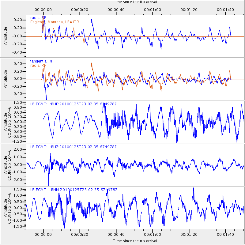
EGMT Eagleton, Montana, USA - Earthquake Result Viewer
*The percent match for this event was below the threshold and hence no stack was calculated.
| Earthquake location: |
Peru-Brazil Border Region |
| Earthquake latitude/longitude: |
-8.5/-74.5 |
| Earthquake time(UTC): |
2010/01/25 (025) 22:52:46 GMT |
| Earthquake Depth: |
147 km |
| Earthquake Magnitude: |
5.7 MB, 5.9 MW, 5.9 MW |
| Earthquake Catalog/Contributor: |
WHDF/NEIC |
|
| Network: |
US United States National Seismic Network |
| Station: |
EGMT Eagleton, Montana, USA |
| Lat/Lon: |
48.02 N/109.75 W |
| Elevation: |
1055 m |
|
| Distance: |
64.3 deg |
| Az: |
334.515 deg |
| Baz: |
140.653 deg |
| Ray Param: |
$rayparam |
*The percent match for this event was below the threshold and hence was not used in the summary stack. |
|
| Radial Match: |
52.7288 % |
| Radial Bump: |
400 |
| Transverse Match: |
49.474213 % |
| Transverse Bump: |
400 |
| SOD ConfigId: |
296938 |
| Insert Time: |
2010-04-06 23:53:49.836 +0000 |
| GWidth: |
2.5 |
| Max Bumps: |
400 |
| Tol: |
0.001 |
|
Signal To Noise
| Channel | StoN | STA | LTA |
| US:EGMT: :BHZ:20100125T23:02:35.674978Z | 2.4862146 | 7.3770576E-7 | 2.9671847E-7 |
| US:EGMT: :BHN:20100125T23:02:35.674978Z | 1.0986696 | 4.8725644E-7 | 4.4349676E-7 |
| US:EGMT: :BHE:20100125T23:02:35.674978Z | 1.64577 | 6.975211E-7 | 4.238266E-7 |
| Arrivals |
| Ps | |
| PpPs | |
| PsPs/PpSs | |


