You are here: Home > Network List > US - United States National Seismic Network Stations List
> Station MSO Missoula, Montana, USA > Earthquake Result Viewer
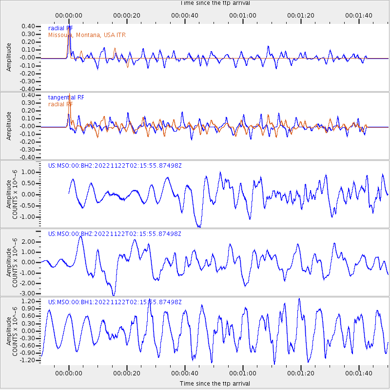
MSO Missoula, Montana, USA - Earthquake Result Viewer
*The percent match for this event was below the threshold and hence no stack was calculated.
| Earthquake location: |
Solomon Islands |
| Earthquake latitude/longitude: |
-9.8/159.6 |
| Earthquake time(UTC): |
2022/11/22 (326) 02:03:07 GMT |
| Earthquake Depth: |
14 km |
| Earthquake Magnitude: |
7.0 Mww |
| Earthquake Catalog/Contributor: |
NEIC PDE/us |
|
| Network: |
US United States National Seismic Network |
| Station: |
MSO Missoula, Montana, USA |
| Lat/Lon: |
46.83 N/113.94 W |
| Elevation: |
1264 m |
|
| Distance: |
94.7 deg |
| Az: |
43.44 deg |
| Baz: |
260.743 deg |
| Ray Param: |
$rayparam |
*The percent match for this event was below the threshold and hence was not used in the summary stack. |
|
| Radial Match: |
78.90354 % |
| Radial Bump: |
400 |
| Transverse Match: |
73.12013 % |
| Transverse Bump: |
380 |
| SOD ConfigId: |
29823551 |
| Insert Time: |
2022-12-06 02:32:52.144 +0000 |
| GWidth: |
2.5 |
| Max Bumps: |
400 |
| Tol: |
0.001 |
|
Signal To Noise
| Channel | StoN | STA | LTA |
| US:MSO:00:BHZ:20221122T02:15:55.87498Z | 3.025742 | 1.3383504E-6 | 4.423214E-7 |
| US:MSO:00:BH1:20221122T02:15:55.87498Z | 1.020581 | 5.364835E-7 | 5.256648E-7 |
| US:MSO:00:BH2:20221122T02:15:55.87498Z | 1.6366098 | 4.5149127E-7 | 2.7586987E-7 |
| Arrivals |
| Ps | |
| PpPs | |
| PsPs/PpSs | |


