You are here: Home > Network List > IU - Global Seismograph Network (GSN - IRIS/USGS) Stations List
> Station WVT Waverly, Tennessee, USA > Earthquake Result Viewer
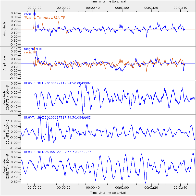
WVT Waverly, Tennessee, USA - Earthquake Result Viewer
*The percent match for this event was below the threshold and hence no stack was calculated.
| Earthquake location: |
Southern Mid-Atlantic Ridge |
| Earthquake latitude/longitude: |
-14.1/-14.6 |
| Earthquake time(UTC): |
2010/01/27 (027) 17:42:45 GMT |
| Earthquake Depth: |
10 km |
| Earthquake Magnitude: |
6.0 MB, 5.6 MS, 5.8 MW, 5.8 MW |
| Earthquake Catalog/Contributor: |
WHDF/NEIC |
|
| Network: |
IU Global Seismograph Network (GSN - IRIS/USGS) |
| Station: |
WVT Waverly, Tennessee, USA |
| Lat/Lon: |
36.13 N/87.83 W |
| Elevation: |
170 m |
|
| Distance: |
85.2 deg |
| Az: |
308.916 deg |
| Baz: |
111.171 deg |
| Ray Param: |
$rayparam |
*The percent match for this event was below the threshold and hence was not used in the summary stack. |
|
| Radial Match: |
63.911407 % |
| Radial Bump: |
361 |
| Transverse Match: |
58.072456 % |
| Transverse Bump: |
400 |
| SOD ConfigId: |
296938 |
| Insert Time: |
2010-04-06 23:59:15.025 +0000 |
| GWidth: |
2.5 |
| Max Bumps: |
400 |
| Tol: |
0.001 |
|
Signal To Noise
| Channel | StoN | STA | LTA |
| IU:WVT: :BHZ:20100127T17:54:50.084998Z | 3.2627704 | 7.038524E-7 | 2.1572231E-7 |
| IU:WVT: :BHN:20100127T17:54:50.084998Z | 1.099923 | 3.5753845E-7 | 3.2505773E-7 |
| IU:WVT: :BHE:20100127T17:54:50.084998Z | 2.16737 | 4.2866765E-7 | 1.977824E-7 |
| Arrivals |
| Ps | |
| PpPs | |
| PsPs/PpSs | |


