You are here: Home > Network List > TA - USArray Transportable Network (new EarthScope stations) Stations List
> Station Z32A Haskell, TX, USA > Earthquake Result Viewer
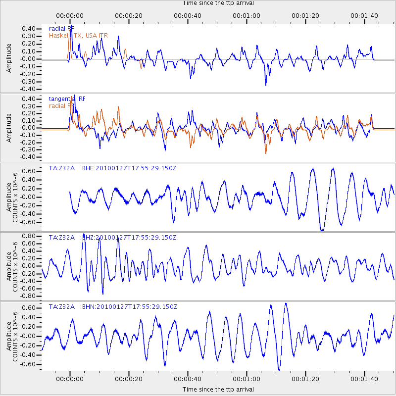
Z32A Haskell, TX, USA - Earthquake Result Viewer
*The percent match for this event was below the threshold and hence no stack was calculated.
| Earthquake location: |
Southern Mid-Atlantic Ridge |
| Earthquake latitude/longitude: |
-14.1/-14.6 |
| Earthquake time(UTC): |
2010/01/27 (027) 17:42:45 GMT |
| Earthquake Depth: |
10 km |
| Earthquake Magnitude: |
6.0 MB, 5.6 MS, 5.8 MW, 5.8 MW |
| Earthquake Catalog/Contributor: |
WHDF/NEIC |
|
| Network: |
TA USArray Transportable Network (new EarthScope stations) |
| Station: |
Z32A Haskell, TX, USA |
| Lat/Lon: |
33.31 N/99.48 W |
| Elevation: |
427 m |
|
| Distance: |
93.5 deg |
| Az: |
303.314 deg |
| Baz: |
104.483 deg |
| Ray Param: |
$rayparam |
*The percent match for this event was below the threshold and hence was not used in the summary stack. |
|
| Radial Match: |
45.14073 % |
| Radial Bump: |
367 |
| Transverse Match: |
57.516525 % |
| Transverse Bump: |
400 |
| SOD ConfigId: |
296938 |
| Insert Time: |
2010-04-07 00:02:20.200 +0000 |
| GWidth: |
2.5 |
| Max Bumps: |
400 |
| Tol: |
0.001 |
|
Signal To Noise
| Channel | StoN | STA | LTA |
| TA:Z32A: :BHZ:20100127T17:55:29.150Z | 2.2736921 | 3.8634414E-7 | 1.6991928E-7 |
| TA:Z32A: :BHN:20100127T17:55:29.150Z | 0.66540056 | 1.7159708E-7 | 2.578854E-7 |
| TA:Z32A: :BHE:20100127T17:55:29.150Z | 1.1274464 | 1.6492504E-7 | 1.4628193E-7 |
| Arrivals |
| Ps | |
| PpPs | |
| PsPs/PpSs | |


