You are here: Home > Network List > TA - USArray Transportable Network (new EarthScope stations) Stations List
> Station 636A Smothers Creek Ranch, Halletsville, TX, USA > Earthquake Result Viewer
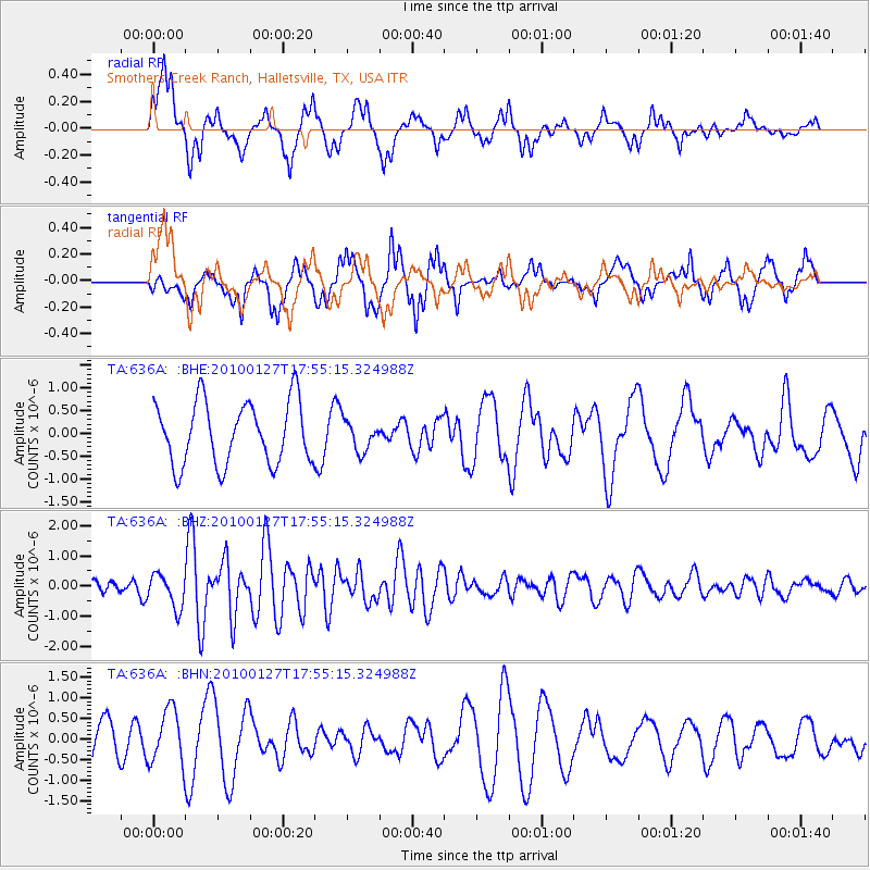
636A Smothers Creek Ranch, Halletsville, TX, USA - Earthquake Result Viewer
*The percent match for this event was below the threshold and hence no stack was calculated.
| Earthquake location: |
Southern Mid-Atlantic Ridge |
| Earthquake latitude/longitude: |
-14.1/-14.6 |
| Earthquake time(UTC): |
2010/01/27 (027) 17:42:45 GMT |
| Earthquake Depth: |
10 km |
| Earthquake Magnitude: |
6.0 MB, 5.6 MS, 5.8 MW, 5.8 MW |
| Earthquake Catalog/Contributor: |
WHDF/NEIC |
|
| Network: |
TA USArray Transportable Network (new EarthScope stations) |
| Station: |
636A Smothers Creek Ranch, Halletsville, TX, USA |
| Lat/Lon: |
29.48 N/97.06 W |
| Elevation: |
90 m |
|
| Distance: |
90.5 deg |
| Az: |
300.174 deg |
| Baz: |
105.847 deg |
| Ray Param: |
$rayparam |
*The percent match for this event was below the threshold and hence was not used in the summary stack. |
|
| Radial Match: |
69.598366 % |
| Radial Bump: |
400 |
| Transverse Match: |
66.61532 % |
| Transverse Bump: |
383 |
| SOD ConfigId: |
296938 |
| Insert Time: |
2010-04-07 00:04:22.865 +0000 |
| GWidth: |
2.5 |
| Max Bumps: |
400 |
| Tol: |
0.001 |
|
Signal To Noise
| Channel | StoN | STA | LTA |
| TA:636A: :BHZ:20100127T17:55:15.324988Z | 1.8316544 | 5.594948E-7 | 3.054587E-7 |
| TA:636A: :BHN:20100127T17:55:15.324988Z | 1.4955643 | 6.6368045E-7 | 4.437659E-7 |
| TA:636A: :BHE:20100127T17:55:15.324988Z | 0.4804254 | 3.2942893E-7 | 6.8570256E-7 |
| Arrivals |
| Ps | |
| PpPs | |
| PsPs/PpSs | |


