You are here: Home > Network List > US - United States National Seismic Network Stations List
> Station ACSO Alum Creek State Park, Ohio, USA > Earthquake Result Viewer
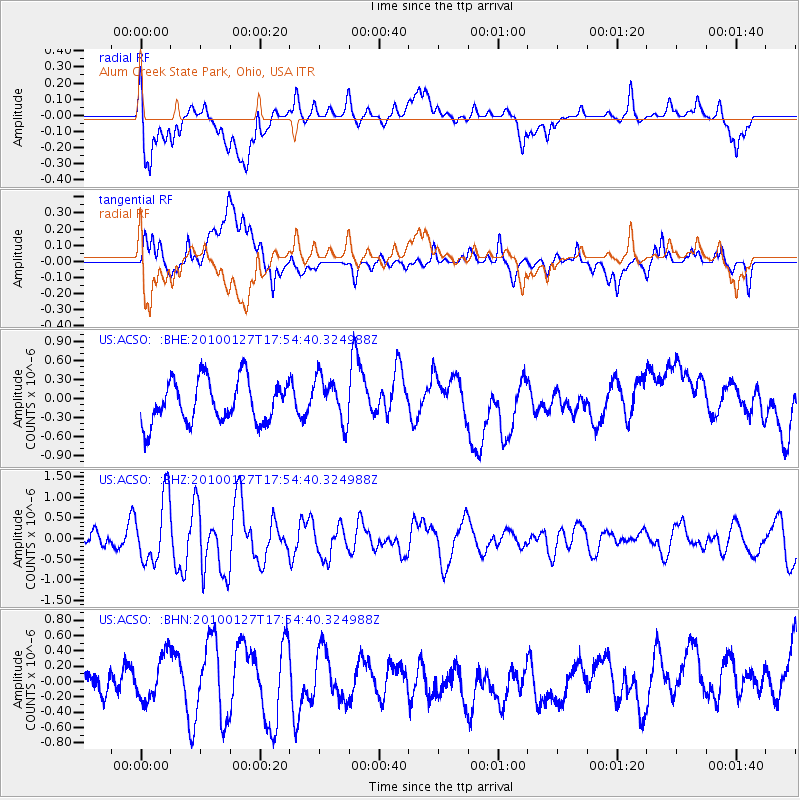
ACSO Alum Creek State Park, Ohio, USA - Earthquake Result Viewer
*The percent match for this event was below the threshold and hence no stack was calculated.
| Earthquake location: |
Southern Mid-Atlantic Ridge |
| Earthquake latitude/longitude: |
-14.1/-14.6 |
| Earthquake time(UTC): |
2010/01/27 (027) 17:42:45 GMT |
| Earthquake Depth: |
10 km |
| Earthquake Magnitude: |
6.0 MB, 5.6 MS, 5.8 MW, 5.8 MW |
| Earthquake Catalog/Contributor: |
WHDF/NEIC |
|
| Network: |
US United States National Seismic Network |
| Station: |
ACSO Alum Creek State Park, Ohio, USA |
| Lat/Lon: |
40.23 N/82.98 W |
| Elevation: |
288 m |
|
| Distance: |
83.3 deg |
| Az: |
314.201 deg |
| Baz: |
114.691 deg |
| Ray Param: |
$rayparam |
*The percent match for this event was below the threshold and hence was not used in the summary stack. |
|
| Radial Match: |
36.9717 % |
| Radial Bump: |
400 |
| Transverse Match: |
60.59 % |
| Transverse Bump: |
400 |
| SOD ConfigId: |
296938 |
| Insert Time: |
2010-04-07 00:04:44.919 +0000 |
| GWidth: |
2.5 |
| Max Bumps: |
400 |
| Tol: |
0.001 |
|
Signal To Noise
| Channel | StoN | STA | LTA |
| US:ACSO: :BHZ:20100127T17:54:40.324988Z | 2.6950727 | 8.0020845E-7 | 2.9691535E-7 |
| US:ACSO: :BHN:20100127T17:54:40.324988Z | 0.9831444 | 3.0103195E-7 | 3.0619302E-7 |
| US:ACSO: :BHE:20100127T17:54:40.324988Z | 1.0630366 | 3.5758805E-7 | 3.363836E-7 |
| Arrivals |
| Ps | |
| PpPs | |
| PsPs/PpSs | |


