You are here: Home > Network List > WY - Yellowstone Wyoming Seismic Network Stations List
> Station YNR Norris Junction, YNP, WY, USA > Earthquake Result Viewer
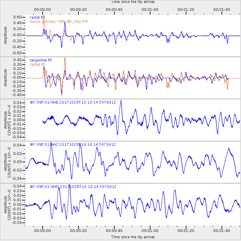
YNR Norris Junction, YNP, WY, USA - Earthquake Result Viewer
*The percent match for this event was below the threshold and hence no stack was calculated.
| Earthquake location: |
North Of Franz Josef Land |
| Earthquake latitude/longitude: |
86.9/55.1 |
| Earthquake time(UTC): |
2017/10/28 (301) 19:11:01 GMT |
| Earthquake Depth: |
10 km |
| Earthquake Magnitude: |
6.0 Mww |
| Earthquake Catalog/Contributor: |
NEIC PDE/us |
|
| Network: |
WY Yellowstone Wyoming Seismic Network |
| Station: |
YNR Norris Junction, YNP, WY, USA |
| Lat/Lon: |
44.72 N/110.68 W |
| Elevation: |
2336 m |
|
| Distance: |
48.5 deg |
| Az: |
346.512 deg |
| Baz: |
1.023 deg |
| Ray Param: |
$rayparam |
*The percent match for this event was below the threshold and hence was not used in the summary stack. |
|
| Radial Match: |
72.844505 % |
| Radial Bump: |
400 |
| Transverse Match: |
63.457817 % |
| Transverse Bump: |
400 |
| SOD ConfigId: |
2973751 |
| Insert Time: |
2018-10-09 00:44:23.970 +0000 |
| GWidth: |
2.5 |
| Max Bumps: |
400 |
| Tol: |
0.001 |
|
Signal To Noise
| Channel | StoN | STA | LTA |
| WY:YNR:01:HHZ:20171028T19:19:14.567991Z | 1.7575448 | 1.596117E-8 | 9.081516E-9 |
| WY:YNR:01:HHN:20171028T19:19:14.567991Z | 1.591794 | 8.341434E-9 | 5.2402727E-9 |
| WY:YNR:01:HHE:20171028T19:19:14.567991Z | 1.2031126 | 7.7098985E-9 | 6.4082935E-9 |
| Arrivals |
| Ps | |
| PpPs | |
| PsPs/PpSs | |


