You are here: Home > Network List > G - GEOSCOPE Stations List
> Station PPTF Pamatai - Papeete - Tahiti island - French Polynesia, France > Earthquake Result Viewer
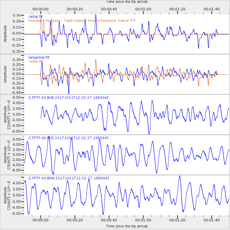
PPTF Pamatai - Papeete - Tahiti island - French Polynesia, France - Earthquake Result Viewer
*The percent match for this event was below the threshold and hence no stack was calculated.
| Earthquake location: |
Seram, Indonesia |
| Earthquake latitude/longitude: |
-3.7/127.8 |
| Earthquake time(UTC): |
2017/10/31 (304) 11:50:51 GMT |
| Earthquake Depth: |
32 km |
| Earthquake Magnitude: |
6.3 Mww |
| Earthquake Catalog/Contributor: |
NEIC PDE/us |
|
| Network: |
G GEOSCOPE |
| Station: |
PPTF Pamatai - Papeete - Tahiti island - French Polynesia, France |
| Lat/Lon: |
17.59 S/149.57 W |
| Elevation: |
705 m |
|
| Distance: |
81.9 deg |
| Az: |
107.149 deg |
| Baz: |
268.688 deg |
| Ray Param: |
$rayparam |
*The percent match for this event was below the threshold and hence was not used in the summary stack. |
|
| Radial Match: |
69.18281 % |
| Radial Bump: |
400 |
| Transverse Match: |
71.774826 % |
| Transverse Bump: |
400 |
| SOD ConfigId: |
2973751 |
| Insert Time: |
2018-10-09 00:59:06.739 +0000 |
| GWidth: |
2.5 |
| Max Bumps: |
400 |
| Tol: |
0.001 |
|
Signal To Noise
| Channel | StoN | STA | LTA |
| G:PPTF:00:BHZ:20171031T12:02:37.198994Z | 1.5297296 | 3.7055975E-6 | 2.4223873E-6 |
| G:PPTF:00:BHN:20171031T12:02:37.198994Z | 0.53831756 | 1.4916917E-6 | 2.7710255E-6 |
| G:PPTF:00:BHE:20171031T12:02:37.198994Z | 1.2802346 | 1.9225045E-6 | 1.5016814E-6 |
| Arrivals |
| Ps | |
| PpPs | |
| PsPs/PpSs | |


