You are here: Home > Network List > GS - US Geological Survey Networks Stations List
> Station KAN13 Rinehart Farm > Earthquake Result Viewer
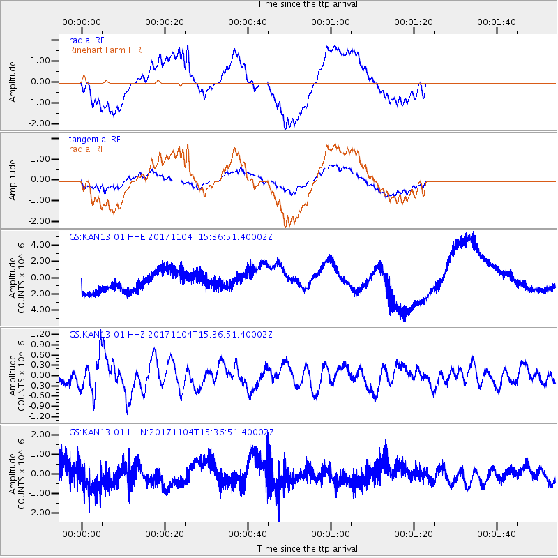
KAN13 Rinehart Farm - Earthquake Result Viewer
*The percent match for this event was below the threshold and hence no stack was calculated.
| Earthquake location: |
Tonga Islands |
| Earthquake latitude/longitude: |
-15.2/-173.3 |
| Earthquake time(UTC): |
2017/11/04 (308) 15:24:31 GMT |
| Earthquake Depth: |
10 km |
| Earthquake Magnitude: |
5.6 mb |
| Earthquake Catalog/Contributor: |
NEIC PDE/us |
|
| Network: |
GS US Geological Survey Networks |
| Station: |
KAN13 Rinehart Farm |
| Lat/Lon: |
37.01 N/97.48 W |
| Elevation: |
340 m |
|
| Distance: |
88.1 deg |
| Az: |
50.95 deg |
| Baz: |
249.517 deg |
| Ray Param: |
$rayparam |
*The percent match for this event was below the threshold and hence was not used in the summary stack. |
|
| Radial Match: |
45.305374 % |
| Radial Bump: |
400 |
| Transverse Match: |
45.093327 % |
| Transverse Bump: |
400 |
| SOD ConfigId: |
2973751 |
| Insert Time: |
2018-10-09 01:20:40.572 +0000 |
| GWidth: |
2.5 |
| Max Bumps: |
400 |
| Tol: |
0.001 |
|
Signal To Noise
| Channel | StoN | STA | LTA |
| GS:KAN13:01:HHZ:20171104T15:36:51.40002Z | 2.4150558 | 5.199593E-7 | 2.152991E-7 |
| GS:KAN13:01:HHN:20171104T15:36:51.40002Z | 1.1259011 | 7.258951E-7 | 6.447237E-7 |
| GS:KAN13:01:HHE:20171104T15:36:51.40002Z | 0.5986226 | 7.2509596E-7 | 1.2112739E-6 |
| Arrivals |
| Ps | |
| PpPs | |
| PsPs/PpSs | |


