You are here: Home > Network List > US - United States National Seismic Network Stations List
> Station HAWA Hanford, Washington, USA > Earthquake Result Viewer
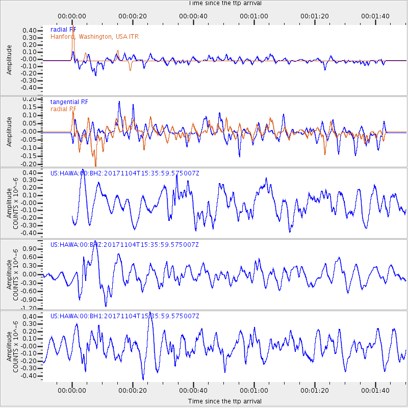
HAWA Hanford, Washington, USA - Earthquake Result Viewer
*The percent match for this event was below the threshold and hence no stack was calculated.
| Earthquake location: |
Tonga Islands |
| Earthquake latitude/longitude: |
-15.2/-173.3 |
| Earthquake time(UTC): |
2017/11/04 (308) 15:24:31 GMT |
| Earthquake Depth: |
10 km |
| Earthquake Magnitude: |
5.6 mb |
| Earthquake Catalog/Contributor: |
NEIC PDE/us |
|
| Network: |
US United States National Seismic Network |
| Station: |
HAWA Hanford, Washington, USA |
| Lat/Lon: |
46.39 N/119.53 W |
| Elevation: |
364 m |
|
| Distance: |
78.1 deg |
| Az: |
34.812 deg |
| Baz: |
232.787 deg |
| Ray Param: |
$rayparam |
*The percent match for this event was below the threshold and hence was not used in the summary stack. |
|
| Radial Match: |
59.77434 % |
| Radial Bump: |
400 |
| Transverse Match: |
50.874966 % |
| Transverse Bump: |
400 |
| SOD ConfigId: |
2973751 |
| Insert Time: |
2018-10-09 01:22:11.069 +0000 |
| GWidth: |
2.5 |
| Max Bumps: |
400 |
| Tol: |
0.001 |
|
Signal To Noise
| Channel | StoN | STA | LTA |
| US:HAWA:00:BHZ:20171104T15:35:59.575007Z | 2.1947584 | 3.9783882E-7 | 1.8126772E-7 |
| US:HAWA:00:BH1:20171104T15:35:59.575007Z | 1.3305092 | 1.8629625E-7 | 1.4001877E-7 |
| US:HAWA:00:BH2:20171104T15:35:59.575007Z | 0.9041845 | 1.6654442E-7 | 1.8419296E-7 |
| Arrivals |
| Ps | |
| PpPs | |
| PsPs/PpSs | |


