You are here: Home > Network List > UU - University of Utah Regional Network Stations List
> Station FORU South Mineral Mountains, UT, USA > Earthquake Result Viewer
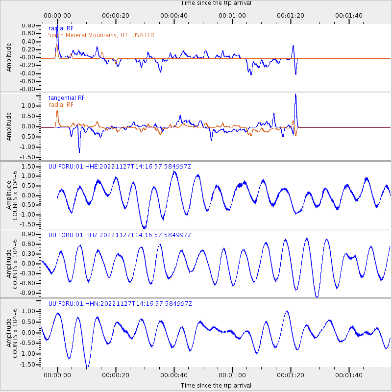
FORU South Mineral Mountains, UT, USA - Earthquake Result Viewer
*The percent match for this event was below the threshold and hence no stack was calculated.
| Earthquake location: |
Pacific-Antarctic Ridge |
| Earthquake latitude/longitude: |
-55.1/-128.5 |
| Earthquake time(UTC): |
2022/11/27 (331) 14:04:10 GMT |
| Earthquake Depth: |
10 km |
| Earthquake Magnitude: |
5.5 Mww |
| Earthquake Catalog/Contributor: |
NEIC PDE/us |
|
| Network: |
UU University of Utah Regional Network |
| Station: |
FORU South Mineral Mountains, UT, USA |
| Lat/Lon: |
38.46 N/112.86 W |
| Elevation: |
1840 m |
|
| Distance: |
94.2 deg |
| Az: |
12.268 deg |
| Baz: |
188.947 deg |
| Ray Param: |
$rayparam |
*The percent match for this event was below the threshold and hence was not used in the summary stack. |
|
| Radial Match: |
62.72896 % |
| Radial Bump: |
400 |
| Transverse Match: |
77.37567 % |
| Transverse Bump: |
400 |
| SOD ConfigId: |
29823551 |
| Insert Time: |
2022-12-11 14:19:02.000 +0000 |
| GWidth: |
2.5 |
| Max Bumps: |
400 |
| Tol: |
0.001 |
|
Signal To Noise
| Channel | StoN | STA | LTA |
| UU:FORU:01:HHZ:20221127T14:16:57.584997Z | 0.9198979 | 3.0887512E-7 | 3.3577106E-7 |
| UU:FORU:01:HHN:20221127T14:16:57.584997Z | 2.7000747 | 8.174958E-7 | 3.0276783E-7 |
| UU:FORU:01:HHE:20221127T14:16:57.584997Z | 2.2750947 | 1.0243634E-6 | 4.5025087E-7 |
| Arrivals |
| Ps | |
| PpPs | |
| PsPs/PpSs | |


