You are here: Home > Network List > TA - USArray Transportable Network (new EarthScope stations) Stations List
> Station C22A Vida, MT, USA > Earthquake Result Viewer
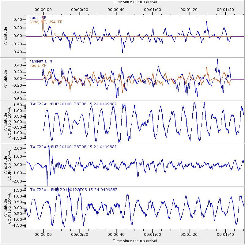
C22A Vida, MT, USA - Earthquake Result Viewer
*The percent match for this event was below the threshold and hence no stack was calculated.
| Earthquake location: |
Jujuy Province, Argentina |
| Earthquake latitude/longitude: |
-23.4/-66.7 |
| Earthquake time(UTC): |
2010/01/28 (028) 08:04:14 GMT |
| Earthquake Depth: |
208 km |
| Earthquake Magnitude: |
5.8 MB, 5.9 MW, 5.9 MW |
| Earthquake Catalog/Contributor: |
WHDF/NEIC |
|
| Network: |
TA USArray Transportable Network (new EarthScope stations) |
| Station: |
C22A Vida, MT, USA |
| Lat/Lon: |
47.75 N/105.88 W |
| Elevation: |
745 m |
|
| Distance: |
79.1 deg |
| Az: |
334.265 deg |
| Baz: |
143.753 deg |
| Ray Param: |
$rayparam |
*The percent match for this event was below the threshold and hence was not used in the summary stack. |
|
| Radial Match: |
33.580334 % |
| Radial Bump: |
362 |
| Transverse Match: |
53.341045 % |
| Transverse Bump: |
315 |
| SOD ConfigId: |
296938 |
| Insert Time: |
2010-04-07 00:36:26.155 +0000 |
| GWidth: |
2.5 |
| Max Bumps: |
400 |
| Tol: |
0.001 |
|
Signal To Noise
| Channel | StoN | STA | LTA |
| TA:C22A: :BHZ:20100128T08:15:24.049988Z | 3.489254 | 1.0749759E-6 | 3.0808187E-7 |
| TA:C22A: :BHN:20100128T08:15:24.049988Z | 0.87530845 | 5.659458E-7 | 6.465673E-7 |
| TA:C22A: :BHE:20100128T08:15:24.049988Z | 1.2384462 | 8.920596E-7 | 7.203055E-7 |
| Arrivals |
| Ps | |
| PpPs | |
| PsPs/PpSs | |


