You are here: Home > Network List > US - United States National Seismic Network Stations List
> Station CBKS Cedar Bluff, Kansas, USA > Earthquake Result Viewer
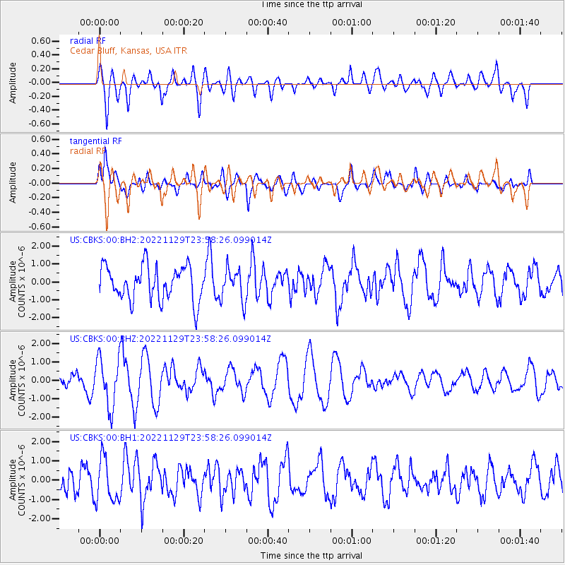
CBKS Cedar Bluff, Kansas, USA - Earthquake Result Viewer
*The percent match for this event was below the threshold and hence no stack was calculated.
| Earthquake location: |
Reykjanes Ridge |
| Earthquake latitude/longitude: |
53.9/-35.1 |
| Earthquake time(UTC): |
2022/11/29 (333) 23:50:37 GMT |
| Earthquake Depth: |
10 km |
| Earthquake Magnitude: |
5.5 Mww |
| Earthquake Catalog/Contributor: |
NEIC PDE/us |
|
| Network: |
US United States National Seismic Network |
| Station: |
CBKS Cedar Bluff, Kansas, USA |
| Lat/Lon: |
38.81 N/99.74 W |
| Elevation: |
677 m |
|
| Distance: |
45.5 deg |
| Az: |
278.022 deg |
| Baz: |
48.571 deg |
| Ray Param: |
$rayparam |
*The percent match for this event was below the threshold and hence was not used in the summary stack. |
|
| Radial Match: |
53.307636 % |
| Radial Bump: |
400 |
| Transverse Match: |
61.41608 % |
| Transverse Bump: |
400 |
| SOD ConfigId: |
29823551 |
| Insert Time: |
2022-12-14 00:19:53.141 +0000 |
| GWidth: |
2.5 |
| Max Bumps: |
400 |
| Tol: |
0.001 |
|
Signal To Noise
| Channel | StoN | STA | LTA |
| US:CBKS:00:BHZ:20221129T23:58:26.099014Z | 3.0918949 | 1.376196E-6 | 4.4509792E-7 |
| US:CBKS:00:BH1:20221129T23:58:26.099014Z | 1.5780175 | 1.1202743E-6 | 7.099252E-7 |
| US:CBKS:00:BH2:20221129T23:58:26.099014Z | 0.95233864 | 9.056302E-7 | 9.5095396E-7 |
| Arrivals |
| Ps | |
| PpPs | |
| PsPs/PpSs | |


