MM13 Spiceland, Indiana - Earthquake Result Viewer
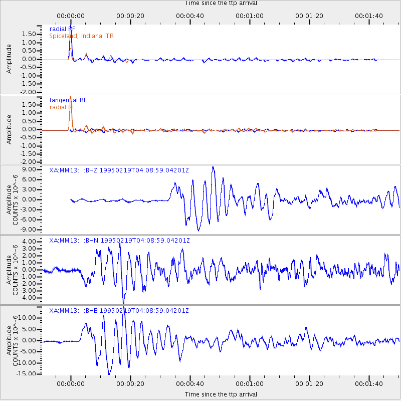
Earthquake location: Off Coast Of Northern California
Earthquake latitude/longitude: 40.6/-125.5
Earthquake time(UTC): 1995/02/19 (050) 04:03:16 GMT
Earthquake Depth: 10 km
Earthquake Magnitude: 6.1 MB, 6.8 MS, 6.7 UNKNOWN, 6.6 MD
Earthquake Catalog/Contributor: WHDF/NEIC
Network: XA Missouri to Massachusetts Transect
Station: MM13 Spiceland, Indiana
Lat/Lon: 39.83 N/85.31 W
Elevation: 337 m
Distance: 30.5 deg
Az: 78.053 deg
Baz: 284.541 deg
Ray Param: 0.07930428
Estimated Moho Depth: 41.25 km
Estimated Crust Vp/Vs: 1.73
Assumed Crust Vp: 6.498 km/s
Estimated Crust Vs: 3.75 km/s
Estimated Crust Poisson's Ratio: 0.25
Radial Match: 97.93463 %
Radial Bump: 229
Transverse Match: 88.41127 %
Transverse Bump: 400
SOD ConfigId: 6273
Insert Time: 2010-02-26 17:53:05.944 +0000
GWidth: 2.5
Max Bumps: 400
Tol: 0.001

Signal To Noise

ChannelStoNSTALTA
XA:MM13: :BHN:19950219T04:08:59.04201Z3.03377416.3638E-72.0976512E-7
XA:MM13: :BHE:19950219T04:08:59.04201Z14.4702612.7754916E-61.918066E-7
XA:MM13: :BHZ:19950219T04:08:59.04201Z6.7956771.7812413E-62.6211387E-7
Arrivals
Ps5.1 SECOND
PpPs16 SECOND
PsPs/PpSs21 SECOND