You are here: Home > Network List > TA - USArray Transportable Network (new EarthScope stations) Stations List
> Station R30A Dighton, KS, USA > Earthquake Result Viewer
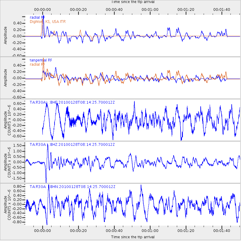
R30A Dighton, KS, USA - Earthquake Result Viewer
*The percent match for this event was below the threshold and hence no stack was calculated.
| Earthquake location: |
Jujuy Province, Argentina |
| Earthquake latitude/longitude: |
-23.4/-66.7 |
| Earthquake time(UTC): |
2010/01/28 (028) 08:04:14 GMT |
| Earthquake Depth: |
208 km |
| Earthquake Magnitude: |
5.8 MB, 5.9 MW, 5.9 MW |
| Earthquake Catalog/Contributor: |
WHDF/NEIC |
|
| Network: |
TA USArray Transportable Network (new EarthScope stations) |
| Station: |
R30A Dighton, KS, USA |
| Lat/Lon: |
38.28 N/100.28 W |
| Elevation: |
776 m |
|
| Distance: |
68.9 deg |
| Az: |
332.209 deg |
| Baz: |
147.01 deg |
| Ray Param: |
$rayparam |
*The percent match for this event was below the threshold and hence was not used in the summary stack. |
|
| Radial Match: |
69.08994 % |
| Radial Bump: |
400 |
| Transverse Match: |
49.570305 % |
| Transverse Bump: |
400 |
| SOD ConfigId: |
296938 |
| Insert Time: |
2010-04-07 00:49:30.504 +0000 |
| GWidth: |
2.5 |
| Max Bumps: |
400 |
| Tol: |
0.001 |
|
Signal To Noise
| Channel | StoN | STA | LTA |
| TA:R30A: :BHZ:20100128T08:14:25.700012Z | 6.036697 | 7.5015026E-7 | 1.2426501E-7 |
| TA:R30A: :BHN:20100128T08:14:25.700012Z | 1.6890521 | 4.4276828E-7 | 2.621401E-7 |
| TA:R30A: :BHE:20100128T08:14:25.700012Z | 0.6576724 | 2.0929947E-7 | 3.1824274E-7 |
| Arrivals |
| Ps | |
| PpPs | |
| PsPs/PpSs | |


