You are here: Home > Network List > UU - University of Utah Regional Network Stations List
> Station CCUT Cedar City, UT, USA > Earthquake Result Viewer
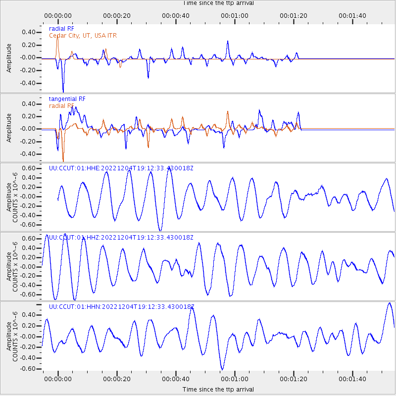
CCUT Cedar City, UT, USA - Earthquake Result Viewer
*The percent match for this event was below the threshold and hence no stack was calculated.
| Earthquake location: |
Southeast Of Loyalty Islands |
| Earthquake latitude/longitude: |
-21.8/170.6 |
| Earthquake time(UTC): |
2022/12/04 (338) 19:00:09 GMT |
| Earthquake Depth: |
144 km |
| Earthquake Magnitude: |
5.5 Mww |
| Earthquake Catalog/Contributor: |
NEIC PDE/us |
|
| Network: |
UU University of Utah Regional Network |
| Station: |
CCUT Cedar City, UT, USA |
| Lat/Lon: |
37.55 N/113.36 W |
| Elevation: |
2127 m |
|
| Distance: |
92.6 deg |
| Az: |
50.55 deg |
| Baz: |
244.584 deg |
| Ray Param: |
$rayparam |
*The percent match for this event was below the threshold and hence was not used in the summary stack. |
|
| Radial Match: |
68.2662 % |
| Radial Bump: |
374 |
| Transverse Match: |
44.409363 % |
| Transverse Bump: |
400 |
| SOD ConfigId: |
29823551 |
| Insert Time: |
2022-12-18 19:17:16.630 +0000 |
| GWidth: |
2.5 |
| Max Bumps: |
400 |
| Tol: |
0.001 |
|
Signal To Noise
| Channel | StoN | STA | LTA |
| UU:CCUT:01:HHZ:20221204T19:12:33.430018Z | 2.1033468 | 4.9684706E-7 | 2.3621739E-7 |
| UU:CCUT:01:HHN:20221204T19:12:33.430018Z | 0.6840512 | 1.9458145E-7 | 2.844545E-7 |
| UU:CCUT:01:HHE:20221204T19:12:33.430018Z | 1.2992623 | 4.0285596E-7 | 3.1006516E-7 |
| Arrivals |
| Ps | |
| PpPs | |
| PsPs/PpSs | |


