You are here: Home > Network List > TA - USArray Transportable Network (new EarthScope stations) Stations List
> Station POKR Poker Plat Research Range, AK, USA > Earthquake Result Viewer
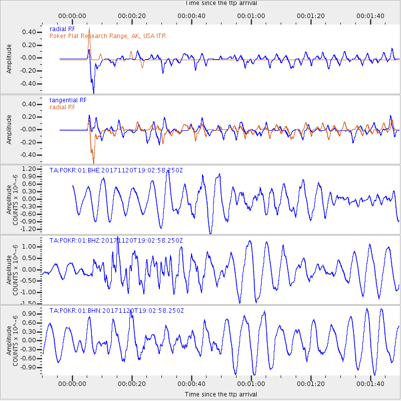
POKR Poker Plat Research Range, AK, USA - Earthquake Result Viewer
*The percent match for this event was below the threshold and hence no stack was calculated.
| Earthquake location: |
Samoa Islands Region |
| Earthquake latitude/longitude: |
-14.4/-175.1 |
| Earthquake time(UTC): |
2017/11/20 (324) 18:51:04 GMT |
| Earthquake Depth: |
10 km |
| Earthquake Magnitude: |
6.2 Mi |
| Earthquake Catalog/Contributor: |
NEIC PDE/pt |
|
| Network: |
TA USArray Transportable Network (new EarthScope stations) |
| Station: |
POKR Poker Plat Research Range, AK, USA |
| Lat/Lon: |
65.12 N/147.43 W |
| Elevation: |
501 m |
|
| Distance: |
82.0 deg |
| Az: |
11.457 deg |
| Baz: |
207.065 deg |
| Ray Param: |
$rayparam |
*The percent match for this event was below the threshold and hence was not used in the summary stack. |
|
| Radial Match: |
80.254745 % |
| Radial Bump: |
400 |
| Transverse Match: |
41.941067 % |
| Transverse Bump: |
384 |
| SOD ConfigId: |
2973751 |
| Insert Time: |
2018-10-09 02:51:21.005 +0000 |
| GWidth: |
2.5 |
| Max Bumps: |
400 |
| Tol: |
0.001 |
|
Signal To Noise
| Channel | StoN | STA | LTA |
| TA:POKR:01:BHZ:20171120T19:02:58.250Z | 0.4361719 | 1.7418245E-7 | 3.9934358E-7 |
| TA:POKR:01:BHN:20171120T19:02:58.250Z | 0.51740974 | 2.5254613E-7 | 4.8809693E-7 |
| TA:POKR:01:BHE:20171120T19:02:58.250Z | 1.0276908 | 4.971257E-7 | 4.8373084E-7 |
| Arrivals |
| Ps | |
| PpPs | |
| PsPs/PpSs | |


