You are here: Home > Network List > TA - USArray Transportable Network (new EarthScope stations) Stations List
> Station 233A Rising Star, TX, USA > Earthquake Result Viewer
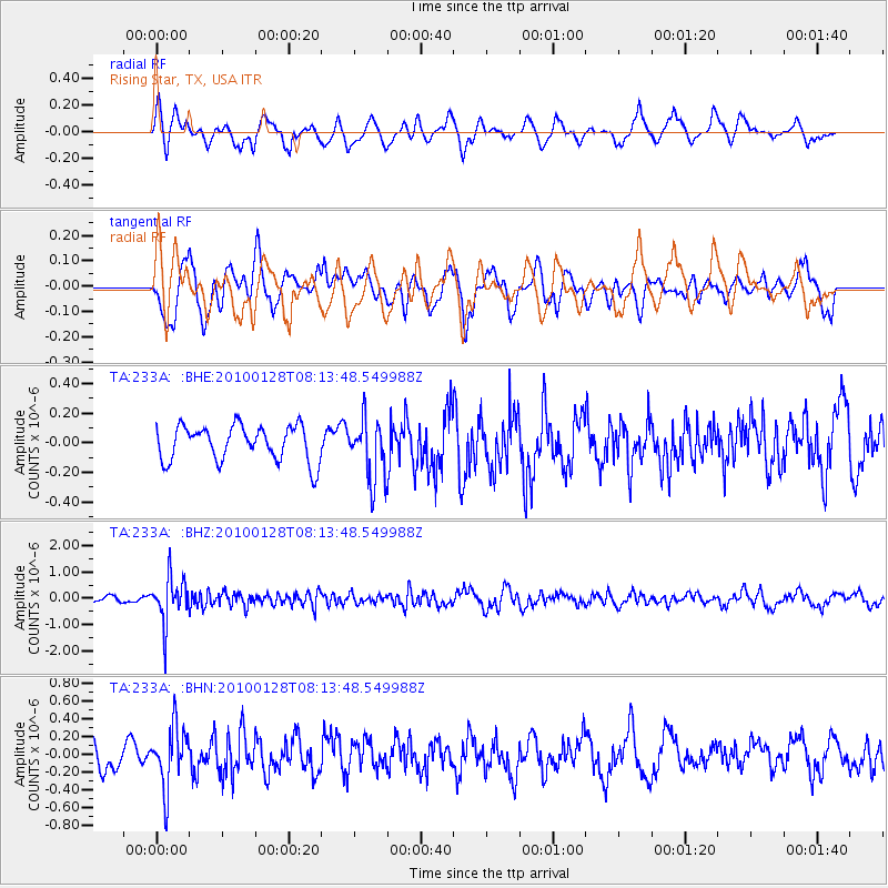
233A Rising Star, TX, USA - Earthquake Result Viewer
*The percent match for this event was below the threshold and hence no stack was calculated.
| Earthquake location: |
Jujuy Province, Argentina |
| Earthquake latitude/longitude: |
-23.4/-66.7 |
| Earthquake time(UTC): |
2010/01/28 (028) 08:04:14 GMT |
| Earthquake Depth: |
208 km |
| Earthquake Magnitude: |
5.8 MB, 5.9 MW, 5.9 MW |
| Earthquake Catalog/Contributor: |
WHDF/NEIC |
|
| Network: |
TA USArray Transportable Network (new EarthScope stations) |
| Station: |
233A Rising Star, TX, USA |
| Lat/Lon: |
32.02 N/98.90 W |
| Elevation: |
539 m |
|
| Distance: |
63.1 deg |
| Az: |
329.503 deg |
| Baz: |
146.699 deg |
| Ray Param: |
$rayparam |
*The percent match for this event was below the threshold and hence was not used in the summary stack. |
|
| Radial Match: |
62.75526 % |
| Radial Bump: |
400 |
| Transverse Match: |
71.39862 % |
| Transverse Bump: |
400 |
| SOD ConfigId: |
296938 |
| Insert Time: |
2010-04-07 01:02:59.451 +0000 |
| GWidth: |
2.5 |
| Max Bumps: |
400 |
| Tol: |
0.001 |
|
Signal To Noise
| Channel | StoN | STA | LTA |
| TA:233A: :BHZ:20100128T08:13:48.549988Z | 10.721887 | 8.6102006E-7 | 8.03049E-8 |
| TA:233A: :BHN:20100128T08:13:48.549988Z | 3.195545 | 3.4586455E-7 | 1.0823335E-7 |
| TA:233A: :BHE:20100128T08:13:48.549988Z | 1.723124 | 2.049078E-7 | 1.1891646E-7 |
| Arrivals |
| Ps | |
| PpPs | |
| PsPs/PpSs | |


