MM13 Spiceland, Indiana - Earthquake Result Viewer
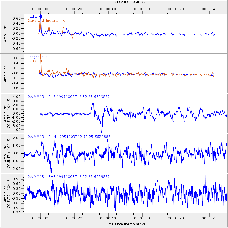
Earthquake location: Peru-Ecuador Border Region
Earthquake latitude/longitude: -2.8/-77.9
Earthquake time(UTC): 1995/10/03 (276) 12:45:00 GMT
Earthquake Depth: 33 km
Earthquake Magnitude: 6.0 MB, 6.1 MS, 5.9 UNKNOWN, 6.4 MW
Earthquake Catalog/Contributor: WHDF/NEIC
Network: XA Missouri to Massachusetts Transect
Station: MM13 Spiceland, Indiana
Lat/Lon: 39.83 N/85.31 W
Elevation: 337 m
Distance: 43.0 deg
Az: 351.619 deg
Baz: 169.103 deg
Ray Param: 0.0727771
Estimated Moho Depth: 62.0 km
Estimated Crust Vp/Vs: 1.71
Assumed Crust Vp: 6.498 km/s
Estimated Crust Vs: 3.794 km/s
Estimated Crust Poisson's Ratio: 0.24
Radial Match: 83.562996 %
Radial Bump: 400
Transverse Match: 53.661816 %
Transverse Bump: 400
SOD ConfigId: 6273
Insert Time: 2010-02-26 17:53:15.466 +0000
GWidth: 2.5
Max Bumps: 400
Tol: 0.001

Signal To Noise

ChannelStoNSTALTA
XA:MM13: :BHN:19951003T12:52:25.662988Z3.62298257.1250594E-71.9666282E-7
XA:MM13: :BHE:19951003T12:52:25.662988Z0.89927971.6130309E-71.7936921E-7
XA:MM13: :BHZ:19951003T12:52:25.662988Z8.8112711.2879341E-61.4616894E-7
Arrivals
Ps7.3 SECOND
PpPs24 SECOND
PsPs/PpSs31 SECOND