You are here: Home > Network List > US - United States National Seismic Network Stations List
> Station EYMN Ely, Minnesota, USA > Earthquake Result Viewer
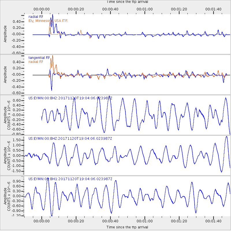
EYMN Ely, Minnesota, USA - Earthquake Result Viewer
*The percent match for this event was below the threshold and hence no stack was calculated.
| Earthquake location: |
Samoa Islands Region |
| Earthquake latitude/longitude: |
-14.4/-175.1 |
| Earthquake time(UTC): |
2017/11/20 (324) 18:51:04 GMT |
| Earthquake Depth: |
10 km |
| Earthquake Magnitude: |
6.2 Mi |
| Earthquake Catalog/Contributor: |
NEIC PDE/pt |
|
| Network: |
US United States National Seismic Network |
| Station: |
EYMN Ely, Minnesota, USA |
| Lat/Lon: |
47.95 N/91.50 W |
| Elevation: |
475 m |
|
| Distance: |
96.3 deg |
| Az: |
42.242 deg |
| Baz: |
255.72 deg |
| Ray Param: |
$rayparam |
*The percent match for this event was below the threshold and hence was not used in the summary stack. |
|
| Radial Match: |
85.54433 % |
| Radial Bump: |
400 |
| Transverse Match: |
54.82713 % |
| Transverse Bump: |
328 |
| SOD ConfigId: |
2973751 |
| Insert Time: |
2018-10-09 02:52:03.099 +0000 |
| GWidth: |
2.5 |
| Max Bumps: |
400 |
| Tol: |
0.001 |
|
Signal To Noise
| Channel | StoN | STA | LTA |
| US:EYMN:00:BHZ:20171120T19:04:06.023987Z | 1.0887012 | 3.156113E-7 | 2.8989706E-7 |
| US:EYMN:00:BH1:20171120T19:04:06.023987Z | 2.0164611 | 6.5855403E-7 | 3.2658897E-7 |
| US:EYMN:00:BH2:20171120T19:04:06.023987Z | 0.80457264 | 2.3286621E-7 | 2.8942844E-7 |
| Arrivals |
| Ps | |
| PpPs | |
| PsPs/PpSs | |


