MM13 Spiceland, Indiana - Earthquake Result Viewer
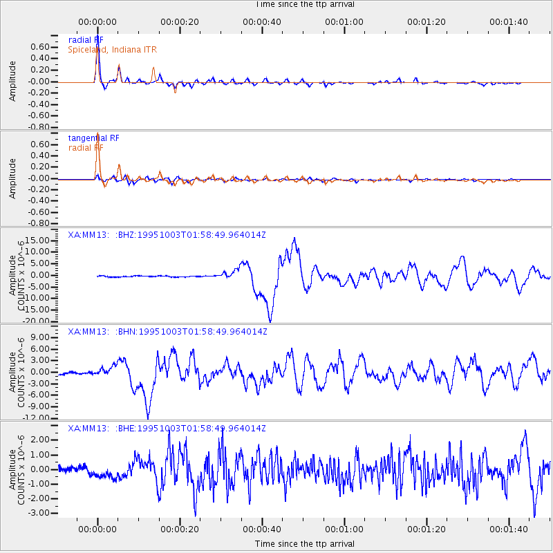
Earthquake location: Peru-Ecuador Border Region
Earthquake latitude/longitude: -2.8/-77.9
Earthquake time(UTC): 1995/10/03 (276) 01:51:24 GMT
Earthquake Depth: 27 km
Earthquake Magnitude: 6.5 MB, 7.0 MS, 6.9 UNKNOWN, 7.0 MW
Earthquake Catalog/Contributor: WHDF/NEIC
Network: XA Missouri to Massachusetts Transect
Station: MM13 Spiceland, Indiana
Lat/Lon: 39.83 N/85.31 W
Elevation: 337 m
Distance: 42.9 deg
Az: 351.598 deg
Baz: 169.075 deg
Ray Param: 0.072820075
Estimated Moho Depth: 30.75 km
Estimated Crust Vp/Vs: 2.06
Assumed Crust Vp: 6.498 km/s
Estimated Crust Vs: 3.162 km/s
Estimated Crust Poisson's Ratio: 0.34
Radial Match: 97.13647 %
Radial Bump: 289
Transverse Match: 87.56956 %
Transverse Bump: 400
SOD ConfigId: 6273
Insert Time: 2010-02-26 17:53:16.587 +0000
GWidth: 2.5
Max Bumps: 400
Tol: 0.001

Signal To Noise

ChannelStoNSTALTA
XA:MM13: :BHN:19951003T01:58:49.964014Z4.80185751.3729447E-62.859195E-7
XA:MM13: :BHE:19951003T01:58:49.964014Z2.18954594.1759162E-71.9072064E-7
XA:MM13: :BHZ:19951003T01:58:49.964014Z10.0269432.2039997E-62.1980773E-7
Arrivals
Ps5.3 SECOND
PpPs14 SECOND
PsPs/PpSs19 SECOND