MM13 Spiceland, Indiana - Earthquake Result Viewer
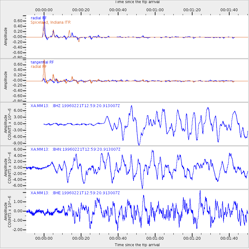
Earthquake location: Off Coast Of Northern Peru
Earthquake latitude/longitude: -9.6/-79.6
Earthquake time(UTC): 1996/02/21 (052) 12:51:04 GMT
Earthquake Depth: 33 km
Earthquake Magnitude: 5.8 MB, 6.6 MS, 7.5 UNKNOWN, 7.3 MW
Earthquake Catalog/Contributor: WHDF/NEIC
Network: XA Missouri to Massachusetts Transect
Station: MM13 Spiceland, Indiana
Lat/Lon: 39.83 N/85.31 W
Elevation: 337 m
Distance: 49.5 deg
Az: 354.182 deg
Baz: 172.542 deg
Ray Param: 0.0686068
Estimated Moho Depth: 37.0 km
Estimated Crust Vp/Vs: 1.85
Assumed Crust Vp: 6.498 km/s
Estimated Crust Vs: 3.522 km/s
Estimated Crust Poisson's Ratio: 0.29
Radial Match: 97.82693 %
Radial Bump: 198
Transverse Match: 87.336365 %
Transverse Bump: 400
SOD ConfigId: 6273
Insert Time: 2010-02-26 17:53:18.721 +0000
GWidth: 2.5
Max Bumps: 400
Tol: 0.001

Signal To Noise

ChannelStoNSTALTA
XA:MM13: :BHN:19960221T12:59:20.913007Z3.26632889.1263865E-72.7940808E-7
XA:MM13: :BHE:19960221T12:59:20.913007Z1.141251.9700391E-71.7262117E-7
XA:MM13: :BHZ:19960221T12:59:20.913007Z7.7047831.7189627E-62.2310331E-7
Arrivals
Ps5.1 SECOND
PpPs15 SECOND
PsPs/PpSs20 SECOND